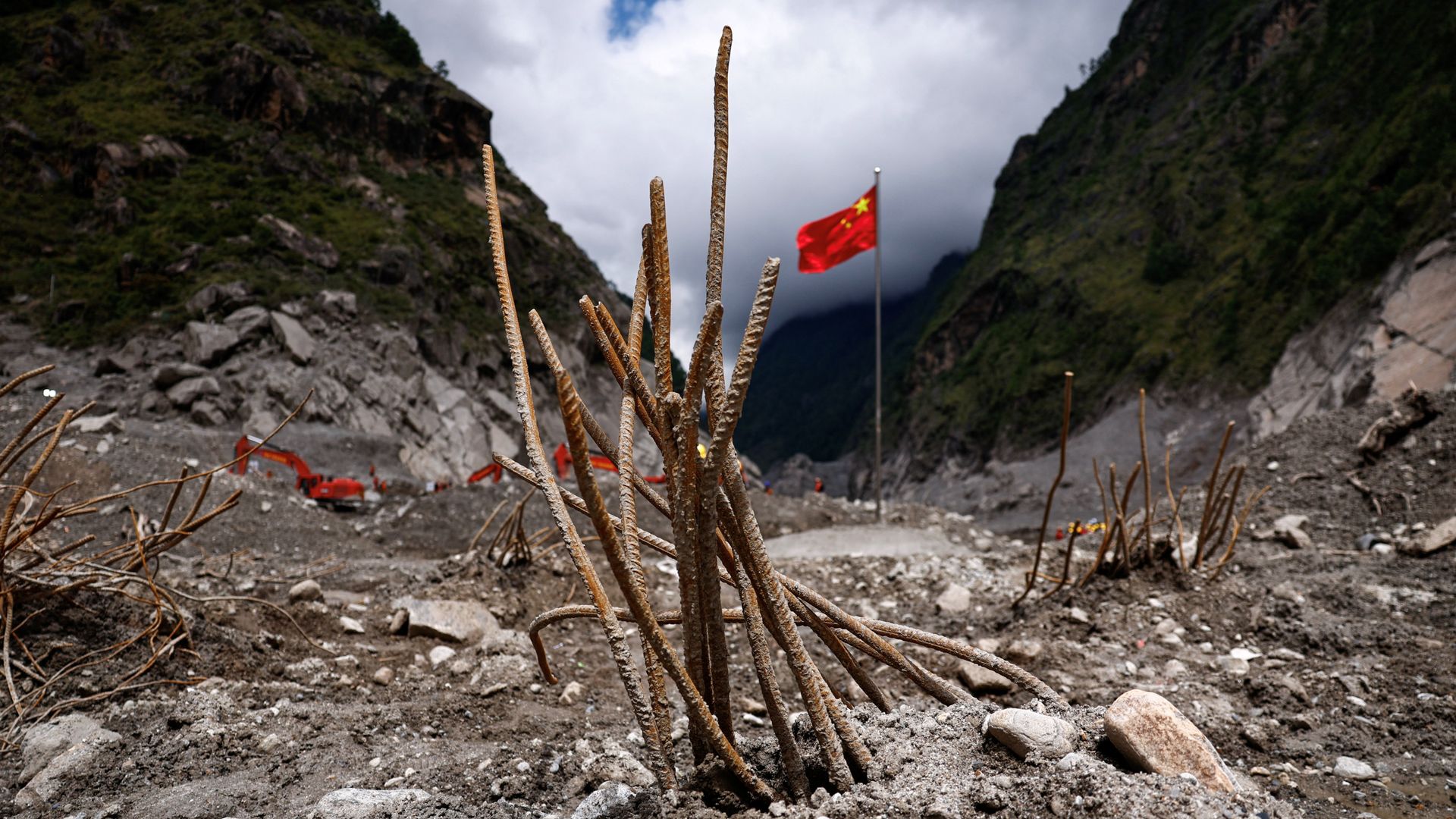
The physical security of high-altitude transboundary basins relies on fragile cryospheric balances that, when compromised, generate catastrophic downstream energy releases. When a glacier on Mount Langtang Lirung fractured at an elevation of 5,200 meters, it initiated a high-velocity ice-rock avalanche that transformed into a massive debris flow across the Nepal-China border. Official metrics place the confirmed death toll past 1,380 combined, with thousands remaining unaccounted for. This event underscores an urgent need to deconstruct the mechanics of glacial lake outbursts, infrastructure vulnerability, and cross-border emergency logistics.
The Physical Mechanics of Cryospheric Collapses
High-altitude disasters are distinct from conventional riverine floods because of their kinetic energy profile. A standard flood accumulates volume through prolonged precipitation, whereas a glacial fracture or ice avalanche introduces millions of tons of solid mass and water into a steep gradient instantaneously.
When the mass detached from Mount Langtang Lirung, the potential energy stored at 5,200 meters converted into kinetic energy within minutes. As the ice and rock slurry descended through narrow Himalayan gorges, it entrained loose sediment, soil, and forest debris, multiplying its mass exponentially before hitting settled valleys like Rasuwa and the Gyirong border crossing in the Xizang Autonomous Region.
[Glacial Fracture at 5,200m]
       │
       ▼ (Kinetic Energy Conversion)
[Ice-Rock Avalanche]
       │
       ▼ (Sediment Entrainment)
[High-Density Debris Flow]
       │
       ▼ (Energy Dissipation)
[Downstream Infrastructure Failure]
This structural evolution explains why standard flood defenses fail. Retaining walls designed for water containment cannot withstand high-density debris flows carrying boulders the size of houses. The energy dissipation occurs violently against the first structural bottlenecks encountered, explaining the total obliteration of immigration buildings, transport hubs, and hydropower installations in the path.
Economic and Infrastructure Vulnerability Functions
The financial and operational toll on the region highlights systemic vulnerabilities in transboundary infrastructure planning. The disaster targeted critical economic arteries, most notably the Gyirong border crossing, which historically handled a substantial percentage of bilateral trade between Nepal and China.
The destruction followed a precise cost function based on asset concentration within narrow river corridors:
- Linear Infrastructure Exposure: Roads, bridges, and transmission lines built along riverbeds serve as the path of least resistance for both commerce and debris flows. Total asset wipeout occurs when energy release exceeds structural load thresholds by orders of magnitude.
- Energy Generation Nodes: Hydropower facilities located in steep river canyons face dual threats. They experience immediate physical destruction from battering ram effects of debris, followed by long-term capacity losses as millions of cubic meters of silt and sediment fill reservoirs and turbine intake tunnels.
- Logistical Isolation: The localized topography turns minor infrastructure breaks into total territorial disconnection. When access roads are sheared away, emergency response times degrade from hours to days, shifting the survival curve sharply downward for trauma victims.
The Information Asymmetry in Transboundary Early Warning
Effective disaster management in shared river basins depends on real-time telemetry sharing across political boundaries. The aftermath of the event exposed friction points in bilateral hazard communication. While scientific institutions maintain cross-border monitoring networks, the translation of raw hydrological data into actionable evacuation orders remains constrained by bureaucratic latency.
When water levels and upstream ice-stability metrics fluctuate, downstream authorities require instantaneous data feeds to trigger automated siren systems. The delay between the initial glacial fracture and the arrival of the surge wave at populated zones leaves a narrow operational window—often measured in minutes. Closing this window requires automated sensor arrays that bypass diplomatic channels to directly alert local municipal command centers.
Strategic Resource Allocation Framework
Emergency response operations in high-altitude disaster zones require a strict triage hierarchy. When local search and rescue teams encounter thousands of missing individuals across rugged terrain, traditional manpower is insufficient.
- Technological Reconnaissance Deployment: Prioritize aerial drones and thermal-imaging life-detecting machines to map unstable mudfields where human rescue crews cannot safely tread without risking secondary avalanches.
- Forensic Identification Infrastructure: Establish standardized DNA profiling protocols immediately. With hundreds of foreign nationals and domestic travelers missing, recovery operations transition quickly from rescue to identification, requiring portable cold storage and rapid genetic sequencing kits at field stations.
- Modular Infrastructure Staging: Replace destroyed concrete bridges with pre-fabricated modular steel spans designed for rapid air-lift deployment, restoring supply chain integrity to cut-off mountain communities before winter weather compounds the crisis.
Deploy immediate structural audits of all high-risk glacial lakes across the Himalayan arc, integrating satellite radar interferometry to monitor ice-wall displacement rates and automate emergency valve releases before pressure thresholds trigger unmanaged catastrophic failures.