When a magnitude 5.2 bedrock failure beneath a high-altitude glacier triggers a catastrophic multi-valley torrent, standard emergency response metrics break down completely. The crossing of the one-thousand-death threshold across the Nepal-China border region following the late August glacial collapse is not merely an unfortunate weather event. It is a diagnostic failure of high-altitude infrastructure vulnerability, hydrological early-warning latency, and remote-terrain search logistics.
Deconstructing the mechanics of this disaster requires examining the three structural vectors that transformed a localized cryospheric failure into a cross-border humanitarian crisis: the kinetic energy release of the glacial outburst, the spatial vulnerability of localized economic hubs, and the logistical friction of rescue operations in complex topography.
The Kinetic Mechanics of Cryospheric Outbursts
Standard flood models rely on sustained precipitation inputs, calculating river discharge curves through predictable catchment area formulas. The late August event bypassed standard meteorological warning systems entirely because its primary driver was cryospheric mechanical failure rather than monsoonal accumulation.
Satellite telemetry indicates that the bedrock support beneath the glacier failed abruptly, generating a seismic shockwave equivalent to a moderate earthquake. This massive rock and ice avalanche dropped millions of tons of solid material into confined Himalayan gorges, displacing immense volumes of water and creating an instantaneous hydraulic surge.
The resulting debris flow operated less like a traditional river flood and more like a high-density pyroclastic surge composed of mud, boulders, and glacial melt. In narrow mountain valleys, this slurry accelerates exponentially, stripping vegetation, obliterating reinforced concrete bridges, and compressing response times from hours to mere seconds. Traditional river-gauge networks, positioned downstream to measure water level increments, register these events only after the kinetic wave has already destroyed the sensor infrastructure.
The Cost Function of Alpine Infrastructure Placement
Economic development in high-altitude regions relies on narrow valley floors where water resources can be harnessed for hydropower or traversed by trade routes. This geographic constraint creates an adverse selection problem: infrastructure assets are intentionally placed directly inside high-risk hydraulic pathways.
The disproportionate concentration of missing persons among hydropower project workers and remote valley inhabitants highlights the structural flaw in alpine industrial planning. Hydro-engineering installations require worker housing and tunneling operations situated adjacent to riverbeds. When a glacial outburst occurs, these installations act as physical traps. Water and debris funneled through narrow gorges encounter artificial bottlenecks, increasing local flow depth and extending the duration of inundation.
Furthermore, trans-boundary river systems complicate accountability and early warning. When a hazard originates in high-altitude territory controlled by one jurisdiction and impacts downstream communities in another, information latency increases. Communication lines between remote outposts are severed during the initial impact, turning downstream valleys into blind spots during the critical first six hours of emergency development.
The Logistical Friction of Search and Rescue Operations
Deploying emergency services across a terrain defined by vertical relief and severed road networks exposes the hard limits of aerial and ground logistics. When bridges collapse and valley walls slide away, the rescue paradigm shifts from rapid deployment to resource starvation.
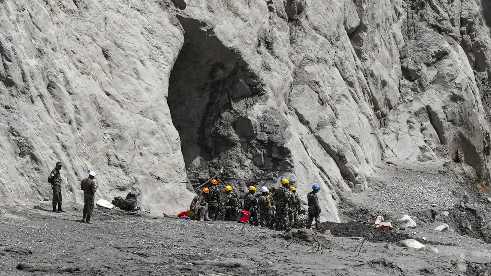
Emergency agencies face a severe logistical bottleneck governed by payload-to-altitude ratios for rotary-wing aircraft. Thin mountain air reduces helicopter lift capacity, restricting evacuation volumes per flight and delaying the insertion of heavy earth-moving equipment needed to clear tunnel entrances and buried access roads.
This environment creates a triage dilemma between immediate survivor extraction and forensic recovery. With thousands of individuals reported missing across remote districts like Nuwakot and Rasuwa, rescue teams must balance active life-saving operations against the public health risks of unrecovered remains in warm, debris-choked valleys. Temporary interments and forensic DNA matching protocols become necessary operational steps, shifting the response timeline from days into months.
Deploy structural sensors directly beneath unstable high-altitude glacial moraines to monitor bedrock micro-fractures, transmitting real-time telemetry via satellite links to bypass terrestrial cell tower vulnerabilities before the next freeze-thaw cycle triggers downstream flash surges.