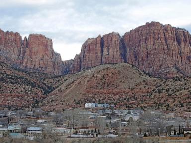
Standing on the precipice of Peavine Peak when the wind shifts feels like standing inside a blast furnace. When the Hawk Fire erupted across the rugged foothills of the Humboldt-Toiyabe National Forest, it didn't just burn brush; it exposed how quickly a modern city can find itself outmatched by a wall of flames.
If you look past the standard headlines reporting acreage and containment percentages, a much harsher reality emerges about living on the western wildland-urban interface. Thousands of people found themselves scrambling with minutes to pack pets, medications, and irreplaceable heirlooms as the fire tore through northwest Reno. Let’s break down what actually happened, why the terrain made this disaster so volatile, and what it means for anyone living near volatile dry brush. Don't miss our recent post on this related article.
The Anatomy of a Wind Driven Disaster
The Hawk Fire didn't spread slowly. Ignited on a Saturday, it ballooned past 15,000 acres in roughly 24 hours. Red-flag wind conditions transformed localized dry brush into an erratic beast that jumped over fire trucks and forced seasoned crews to pull back for safety.
Most people assume firefighters can simply build lines ahead of an advancing front, but the reality on the ground is far messier. Shifting winds sent embers flying in opposing directions, creating spot fires that rendered traditional evacuation maps obsolete within minutes. Local officials had to scale mandatory "GO NOW" evacuation orders to cover tens of thousands of residents, pushing right up to the edge of the University of Nevada campus. To read more about the background of this, NPR provides an excellent breakdown.
The terrain itself acted as an accelerant. The steep canyons and dense pockets of dry vegetation around Peavine Peak funnel wind like a jet nozzle. When you combine dry weather, high heat, and erratic gusts, standard fire suppression tactics hit a hard ceiling until the weather breaks.
Human Causes and the Trouble with Recreation Zones
Authorities confirmed early on that the Hawk Fire was human-caused, though investigators classified the exact origin as an open investigation. Whether it stemmed from an unattended campfire, vehicle exhaust, or equipment use, the trigger points out a brutal vulnerability.
The foothills north of Reno see heavy weekend recreation traffic, from hikers to off-road vehicles. When the ground is baked bone-dry after weeks of high temperatures and low humidity, a single stray spark from an exhaust pipe or an illegal fire creates catastrophic consequences. Public land management agencies deal with an impossible math problem: keeping millions of acres open for public enjoyment while preventing human carelessness from wiping out entire neighborhoods.
Property losses climbed past 32 destroyed homes as damage assessment teams finally pushed into the interior of the burn zone. Families like the Oppersans and the Kieffers lost everything, recounting moments where real-time tracking apps lagged behind the actual fire front, leaving them with seconds to escape with their lives.
Surviving the New Normal on the Wildland Edge
Living in northern Nevada or anywhere along the western corridor means accepting a tense reality check. Traditional defensible space guidelines—clearing brush, cleaning gutters, and creating buffer zones—help, but extreme wind events test even the most prepared properties.
If you live anywhere near the interface of open timber and residential development, preparation has to go beyond having a packed go-bag.
- Track multiple data sources: Relying on a single evacuation app can be fatal if cellular towers overload or data lags behind fast-moving winds. Listen to local emergency radio broadcasts and follow county sheriff updates directly.
- Hardened home maintenance: Embers travel miles ahead of the actual flame front. Installing multi-pane tempered glass, metal mesh vent covers, and non-combustible siding prevents the most common vector of home ignition.
- Immediate compliance: When deputies and fire chiefs issue a mandatory evacuation, arguing or waiting to see how the wind turns wastes critical minutes that first responders might need to save your life.
The 900-plus firefighters brought in from across the United States, alongside international crews from Australia and New Zealand, managed to bring containment up to 27 percent as winds finally began to ease. Even so, thousands remained displaced under strict warnings while hot spots smoldered in the canyons.
The smoke clears eventually, but the underlying risk remains baked into the landscape. Protecting these communities demands a complete shift in how developers build, how residents maintain defensible property lines, and how everyone approaches fire safety during the dry months.