Photo-led coverage of post-monsoon festivals on Myanmar's Inle Lake treats a complex hydro-social event as a static visual spectacle, missing the hydrological shifts, religious calendars, and coordination mechanics that make the gathering possible. A rigorous analysis reconstructs the underlying system across four layers: the Hydrological Cycle of Inle Lake, the Ritual Synchronization Architecture, the Fluvial Logistics Engine, and the Risk and Friction Profile. Readers who want to understand why these waterborne gatherings happen when they do, how communities coordinate across stilt settlements and floating gardens, and where visual storytelling breaks down will find a structured blueprint here rather than a collection of captions.
Standard photo stories rely on three implicit assumptions that flatten reality. First, they assume the festival is a discrete cultural moment detached from seasonal water depth, sediment inflow, and navigational clearance. Second, they treat visual spectacle—gilded barges, traditional dress, massed canoes—as self-explanatory rather than the output of months of labor allocation and ritual scheduling. Third, they conflate visible joy in photographs with frictionless operations, ignoring security constraints, weather volatility, and economic strain on households. Separating known structural mechanics from educated hypotheses about local adaptation turns a postcard into an analytical model. You might also find this similar story insightful: What Most Families Miss About Snorkeling Currents After a Bahamas Tragedy.
The Hydrological Cycle of Inle Lake
Inle Lake sits in Shan State at roughly 880 meters above sea level, fed by mountain streams and drained primarily through the Nam Pilu (Balu Chaung) river system. Because the lake basin is shallow and sensitive to seasonal rainfall and runoff, the end of the southwest monsoon marks a decisive operational inflection point rather than a mere change of sky. During peak monsoon months, heavy precipitation and upland runoff elevate water levels, swell tributary inflows, and transport silt and floating vegetation from surrounding slopes and marsh margins. Once monsoon rains recede in early autumn, water levels stabilize near seasonal highs before gradually receding over the dry months.
For waterborne festivals held around the close of the monsoon—most notably the Phaung Daw Oo Pagoda festival in the lunar calendar's Thadingyut period—hydrology governs both access and hazard. Higher post-monsoon water depth opens shallow channels and fringes around stilt villages and monastery landings that can become restrictive later in the dry season. At the same time, lingering currents, wind fetch across open water, and dense aquatic weeds or floating agricultural mats introduce real navigation constraints for long narrow boats and towed ceremonial vessels. As highlighted in recent coverage by Condé Nast Traveler, the implications are worth noting.
Consider a village boat crew moving from a stilt settlement to a designated assembly point along the lake margin. If they depart along a shallow reed-lined channel right after heavy rain, higher water reduces grounding risk compared to late spring, yet submerged debris and shifting floating gardens can still snag poles or propellers. Visual coverage rarely shows the bathymetric trade-off behind a smooth-looking procession, yet water depth and wind state are the hard physical constraints on every movement on the lake.
- Water depth and channel clearance: Determines whether shallow village canals and temple jetties can receive larger or multi-boat assemblies without grounding.
- Runoff and sedimentation: Shapes water turbidity, weed drift, and bank erosion after heavy seasonal rains.
- Wind and fetch dynamics: Affects surface chop and stability across open expanses of the lake, especially for tall or multi-hull ceremonial craft.
- Seasonal transition timing: Marks the shift from high-rainfall runoff management to post-monsoon water retention and harvest readiness.
The Ritual Synchronization Architecture
A festival on Inle Lake is not a spontaneous street party; it is a synchronized multi-node calendar event anchored in Theravada Buddhist observance and local Intha community traditions. In the post-monsoon window, Thadingyut marks the end of the three-month Vassa (rains retreat), a structural pivot in the monastic and lay calendar when travel resumes more freely, merit-making intensifies, and communities gather across villages and monasteries.
Synchronizing dozens or hundreds of boats, monastic hosts, lay committees, and spectators across a fragmented water geography requires a clear coordination protocol. Rather than a single central command center operating like a corporate control room, the system relies on staggered host legs, pre-agreed landing nodes, and customary role division. In the Phaung Daw Oo circuit, sacred Buddha images move in stages between monasteries and villages over multiple days, turning the lake itself into a moving corridor of ritual transfer.
A useful way to model this is a Three-Pillar Synchronization Framework:
- Temporal Cadence: Lunar observance dates set the macro-window, while daily departure, transit, and arrival blocks keep multi-stop water routes on schedule.
- Spatial Routing: Fixed shrines, monastery landings, and village assembly points act as routing hubs that connect dispersed stilt settlements and lakeside communities.
- Role Specialization: Monastic authorities, local festival committees, boat owners, rowers, and households each carry distinct duties, from ceremonial protocol to vessel handling and hospitality.
When a photograph captures a crowd lining wooden walkways or leaning from canoes near a shrine, it shows the output of this architecture. The hidden coordination cost lies in aligning dozens of independent boat operators and village delegations so they arrive in sequence without clogging narrow approaches or missing tide-like local water windows.
The Fluvial Logistics Engine
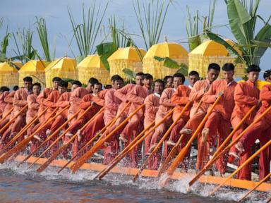
Once people and ceremonial objects move onto the water, the festival operates as a Fluvial Logistics Engine governed by hull physics, propulsion ergonomics, and queue dynamics. On Inle Lake, the iconic leg-rowing (thaing-ye) technique is more than a visual signature; it is an ergonomic adaptation for shallow, weed-choked waters and narrow craft. Standing at the stern with one leg wrapped around an oar while the other balances on the gunwale frees the hands to steer or pole while keeping the operator's eyes elevated above reeds and floating vegetation to spot channels and obstacles.
Scaling from one fisherman working a narrow skiff to a crowded festival flotilla changes the physics and traffic flow. Adding passengers or ceremonial superstructures increases displacement and draft, alters trim, and expands windage. Meanwhile, motor-powered longtail or utility boats operating alongside paddle and leg-rowed craft create wake interactions and speed differentials that require disciplined spacing.
Trace a practical sequence for a single ceremonial transit leg to see how the engine works:
- Pre-launch staging: Boats assemble near designated departure points, balancing passenger weight and securing cargo or ceremonial fittings so trim stays level.
- Channel entry and queue formation: Craft enter main waterways in staggered order, matching speed to lead vessels to prevent bottlenecks at narrow constrictions.
- Open-water transit: Crews manage crosswinds and wakes from passing motorized boats, adjusting heading and cadence to keep formation intact.
- Landing and turnaround: Vessels approach crowded docks or banks at low speed, offload or receive delegations, and clear the landing zone so following boats can berth safely.
The second limitation of photo-driven reporting is that still images freeze motion without showing bottleneck propagation. A single slow or stalled vessel at a narrow canal mouth or crowded jetty can back up dozens of trailing boats, turning a ceremonial procession into a holding pattern.
The Risk and Friction Profile
Post-monsoon timing lowers some weather risks compared to peak monsoon downpours, yet it introduces a distinct set of operational hazards and socio-economic trade-offs. Overloading traditional wooden boats for high-attendance festival days raises freeboard concerns—meaning less margin between the waterline and the gunwale—especially if passengers shift suddenly or wakes hit broadside. Crowded landings, makeshift viewing platforms, and night or low-light returns after dusk add further safety friction.
Beyond physical safety, major festivals impose opportunity costs on local households and communities. Rowing, hosting guests, preparing offerings, and running transport boats take labor away from farming, fishing, weaving, or floating-garden maintenance during a busy agricultural transition. In recent years, broader political instability, security checkpoints, travel restrictions, and economic pressures in Myanmar have added another layer of friction, affecting regional mobility, supply availability, and visitor arrivals.
An educated hypothesis—distinct from confirmed local incident data—is that household participation balances spiritual obligation and social prestige against fuel costs, boat maintenance, and foregone daily income. When input costs rise or mobility is constrained, smaller or more localized boat turnouts become a rational adaptation rather than a sign of fading cultural attachment.
- Overloading and stability: Extra passengers and ceremonial weight reduce buoyancy margin and increase capsize risk in chop or wake.
- Congestion at choke points: Narrow waterways and popular landings create crowding and collision or fall risks during peak arrivals.
- Weather and visibility shifts: Sudden squalls, strong afternoon breezes, or poor visibility after dark complicate navigation.
- Economic and mobility friction: Fuel expenses, maintenance backlogs, and broader regional travel or security constraints can limit scale and outside participation.
Analytical Audit of Competitor Coverage
A headline like "Photos show festival on Myanmar's Inle Lake after the end of monsoon" signals a visual-first, event-snapshot format. That format excels at immediate sensory impression—showing color, water, and crowd scale—but it systematically under-delivers on causal explanation. By leading with photos rather than a structural model, such coverage leaves readers guessing what "after the end of monsoon" changes operationally, how multi-day lake routes are coordinated, and what risks sit behind the scenes.
This creates a clear analytical gap for readers and analysts. Where photo roundups stop at surface description, structured analysis connects seasonal hydrology, ritual calendars, fluvial logistics, and risk constraints into one causal chain. It also forces discipline around evidence: stating clearly what is established about Inle Lake's geography and festival mechanics, while flagging hypotheses where granular, real-time local figures are not publicly verified.
Strategic Play for Coverage and Field Analysis
To outperform standard photo-led reporting on Inle Lake's post-monsoon festivals, editors, researchers, and trip planners should pair visual documentation with a Four-Layer Field Brief before publishing or traveling:
- Anchor every visual in a seasonal state: Pair each photograph or observation with the exact seasonal phase (late monsoon transition, Thadingyut festival window, or early dry season) and note observable water and wind conditions.
- Map the routing nodes, not just the crowd: Identify the start point, intermediate landings, and end point of a boat movement so readers see spatial progression rather than isolated scenes.
- Audit vessel capacity and traffic choke points: Note boat types, propulsion mix (leg-rowed, paddled, motorized), load density, and any narrow passages or crowded docks where delays cluster.
- Separate verified facts from inferred motives: State directly what was observed or documented, and label interpretations of economic cost, political impact, or community sentiment as hypotheses unless corroborated by multiple local sources.