Municipal development within active volcanic zones presents a fundamental paradox: high-yield agrarian or logistical geography coupled with tail-risk asset destruction. The systemic vulnerability of these metropolitan areas is governed by a tripartite risk equation. This framework quantifies exposure based on proximity, geological morphology, and infrastructural velocity limitations.
Risk = Hazard Exposure (Morphology) × Asset Density (Urbanization) × Evacuation Latency (Infrastructural Velocity)
The primary driver of urban placement near volcanic centers is economic optimization. Volcanic materials decompose into exceptionally fertile soils rich in potassium and phosphorus, optimizing agricultural yields. Furthermore, coastal volcanic formations, such as the Bay of Naples, provide ideal natural harbors that establish critical trade nodes. This localized economic yield introduces a profound collective action problem. Immediate financial incentives consistently outperform low-probability, high-consequence catastrophic events in urban planning models.
The Core Mechanisms of Volcanic Destruction
To evaluate the existential risk to proximal cities, the generic term "volcanic eruption" must be separated into distinct physical phenomena. Each mechanism imposes different structural stresses on urban infrastructure, requiring unique mitigation strategies.
Effusive Fissure Flows
Characterized by low-viscosity basaltic magma, effusive eruptions present a primary threat to fixed assets rather than human life. The destruction mechanism is thermodynamic and kinetic. As lava advances, it consumes infrastructure via thermal ignition and mechanical burial.
The spatial trajectory of these flows is governed by fluid dynamics and topography. While predictable via high-resolution digital elevation models, the sheer volume of material can overwhelm engineered containment barriers, rendering static defense systems ineffective over sustained eruption timelines.
Pyroclastic Density Currents
Pyroclastic density currents represent the absolute ceiling of urban volcanic hazard severity. These flows are superheated, gas-saturated clouds of ash, pumice, and volcanic rock that travel at speeds exceeding 100 meters per second.
The kinetic energy of a pyroclastic surge is sufficient to shear reinforced concrete structures from their foundations. Simultaneously, thermal profiles exceeding 500 degrees Celsius guarantee instantaneous mortality for exposed populations. Atmospheric infiltration of these currents neutralizes indoor sheltering strategies, turning buildings into thermal traps.
Lahars
Lahars are hyper-concentrated sediment flows composed of water, volcanic ash, and debris. They possess a rheology similar to liquid concrete, maintaining high bulk density and fluid mobility.
Lahar Velocity Vector = (Slope Angle × Water-to-Sediment Ratio) - Topographic Roughness
A lahar behaves as a structural battering ram. It navigates river valleys and alluvial plains at high velocities, completely obliterating bridges, transportation networks, and residential foundations. Because lahars can be triggered by heavy rainfall on accumulated ash deposits months after an initial eruption, they decouple the timeline of risk from the volcanic event itself.
High-Exposure Municipalities and Structural Vulnerabilities
Naples, Italy: The Peak Density Bottleneck
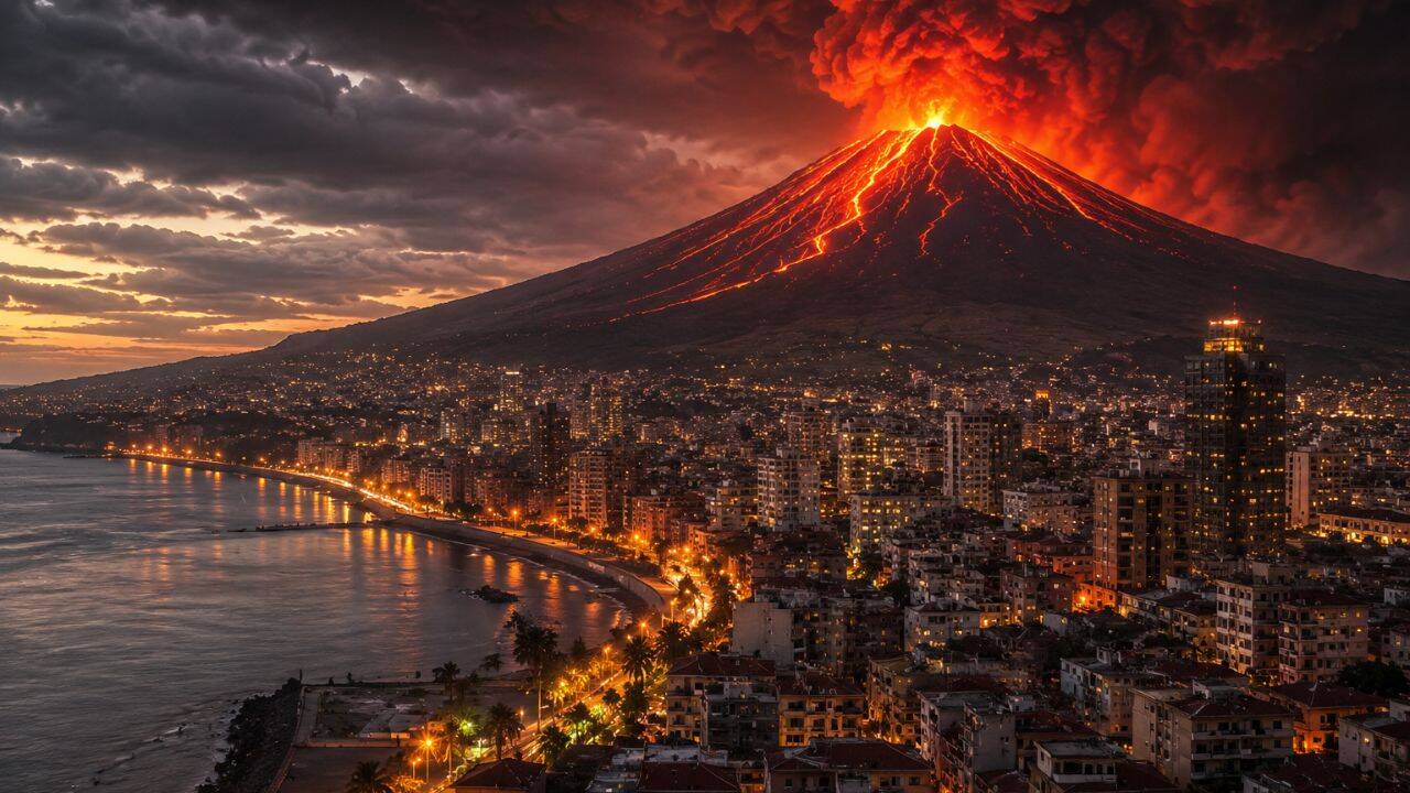
The metropolitan area of Naples sits at the intersection of two distinct volcanic systems: Mount Vesuvius to the east and the Campi Flegrei caldera to the west. This creates a compounding exposure profile affecting over three million residents.
The principal bottleneck in the Neapolitan risk profile is evacuation latency. The urban layout of Naples features dense, historical architecture and narrow transportation corridors that cannot handle sudden mass movement. Emergency management plans rely on a 72-hour advance notice to evacuate the "Red Zone."
The core vulnerability lies in the assumption of linear escalations in volcanic unrest. If Vesuvius experiences a sudden column collapse producing pyroclastic density currents without a prolonged seismic prelude, the transportation infrastructure will experience systemic failure within the first two hours. This reality makes successful mass evacuation mathematically impossible under current population densities.
Orting, United States: The Kinetic Lahar Conduit
Orting, Washington, is built entirely upon the Electron Mudflow deposit—a historic lahar generated by Mount Rainier roughly 500 years ago. The city occupies a low-lying valley that acts as a natural drainage channel for the Puyallup River, making it highly susceptible to future flows.
The structural threat to Orting is defined by a hard telemetry constraint. A major lahar initiated on the western flanks of Mount Rainier will reach the city limits within approximately 40 to 60 minutes.
Rainier Flank Instability → Debris Avalanche + Glacial Melt → High-Density Lahar Flow → Valley Inundation (40-min Travel Time)
This compressed timeline eliminates the possibility of orderly vehicular evacuation via the region’s limited highway network. Instead, survival depends on rapid pedestrian movement to local high ground. This system is highly dependent on automated acoustic flow monitors located upstream to provide immediate alerts.
Pahoa, United States: Basaltic Fissure Infiltration
Pahoa, Hawaii, is located within Zone 2 of the United States Geological Survey’s hazard mapping for the Kīlauea volcano. This environment is characterized by effusive basaltic eruptions operating along the Lower East Rift Zone. The mechanics of the 2018 eruption demonstrated the vulnerability of this region, where 24 open fissures destroyed over 700 homes and covered 13.7 square miles of land.
The hazard profile for Pahoa is defined by structural isolation. Basaltic lava flows follow local topography, cutting off critical linear infrastructure like roads, power grids, and water lines long before entering the town center. The economic risk is driven by property uninsurability and the permanent destruction of transportation networks. This forces a strategy of managed retreat rather than structural fortification.
Kagoshima, Japan: Sustained Ash Saturation
Kagoshima is situated directly across the bay from Sakurajima, one of Japan's most active volcanoes. The city experiences near-continuous, small-scale explosive eruptions that deposit ash plumes across the municipal area.
The vulnerability here is structural wear and infrastructure degradation rather than sudden catastrophe. Chronic ashfall causes significant challenges:
- Grid Instability: Conductive volcanic ash settles on electrical substations, causing short circuits and widespread power failures during periods of high humidity.
- Logistical Disruptions: Rail networks and airport runways require immediate closure when ash accumulates to prevent engine abrasion and mechanical failure.
- Structural Load: Accumulations of heavy ash can exceed the structural load limits of traditional roofs, leading to building collapses during prolonged eruption cycles.
Toutle, United States: Post-Eruptive Debris Management
The town of Toutle, Washington, located downstream from Mount St. Helens, illustrates the long-term systemic costs of volcanic activity. The 1980 eruption altered the North Fork Toutle River valley, filling it with millions of tons of unstable volcanic debris.
The threat to Toutle is a continuous battle against sediment transport. Rain re-mobilizes ash and debris, creating secondary lahars and severe river channel aggradation. This raises water levels and increases flood risks.
To manage this risk, engineers constructed a massive Sediment Retention Structure (SRS) to trap debris before it reaches populated areas. The operational constraint is that the SRS requires ongoing maintenance and height adjustments. This turns volcanic risk mitigation into a permanent municipal expense.
Mammoth Lakes, United States: Subsurface Gas Accumulation
Mammoth Lakes, California, sits on the boundary of the Long Valley Caldera, a massive volcanic system that exhibits ongoing magmatic unrest. Unlike cities threatened by surface lava, Mammoth Lakes faces a silent, invisible hazard: magmatic carbon dioxide ($CO_2$) degassing.
The gas migrates through fault lines and soils, collecting in low-lying areas and depressions. Because $CO_2$ is denser than ambient air, it displaces oxygen, creating lethal micro-environments that have destroyed vast areas of surrounding forest.
The urban risk is concentrated in enclosed basements, subterranean utility vaults, and snow-drifted structures. This requires mandatory gas detection infrastructure and continuous atmospheric monitoring to prevent asphyxiation events without any visible signs of volcanic activity.
Infrastructure Design and Emergency Latency
Standard urban engineering models assume stationary environmental hazards. Volcanic proximity invalidates this assumption. Mitigating these risks requires converting traditional infrastructure into dynamic defense networks designed for extreme energy dissipation and rapid evacuation.
+-----------------------------------------------------------------------+
|                       VOLCANIC MITIGATION MATRIX                      |
+------------------------------------+----------------------------------+
| MECHANISM                          | STRUCTURAL/TACTICAL RESPONSE     |
+------------------------------------+----------------------------------+
| Pyroclastic Density Currents       | Reinforced concrete structures   |
|                                    | Aerodynamic building profiles    |
|                                    | Automated airtight sealing       |
+------------------------------------+----------------------------------+
| Lahars / Mudflows                  | Upstream deflection berms        |
|                                    | Grade-separated vertical escapes |
|                                    | Acoustic flow detection arrays   |
+------------------------------------+----------------------------------+
| Effusive Lava Flows                | Hydraulic chilling channels      |
|                                    | Sacrificial earthen dikes        |
|                                    | Topographic micro-modeling       |
+------------------------------------+----------------------------------+
The Failure of Static Defenses
Earthen dikes and concrete deflection barriers offer limited protection against large volcanic events. Lava flows can pool against barriers, rising until they overtop the structure. Similarly, lahars can erode the foundations of deflection walls, causing them to collapse.
Engineering investments yield the highest return when focused on increasing evacuation velocity. This involves building grade-separated pedestrian flyovers that bypass highway gridlock, installing automated siren networks tied to real-time seismic arrays, and constructing vertical evacuation shelters designed to withstand high kinetic impacts and thermal loads.
Strategic Playbook for High-Risk Municipal Management
Municipalities located in active volcanic zones face a clear choice: implement rigorous structural reforms or accept eventual catastrophic asset loss. The economic reality is that the cost of inaction escalates non-linearly as urban density grows.
To manage this risk, local governments must implement a structured, multi-phase operational strategy:
- Enact Immediate Topographic Zoning Bans: Restrict new high-density development in known alluvial channels, lahar paths, and topographically low-lying zones near active vents.
- Mandate Specialized Building Codes: Require all new structures within a 20-kilometer radius of active volcanic centers to feature reinforced sloped roofs designed for heavy ash loads ($>200 \text{ kg/m}^2$) and automated air-filtration intake closures.
- De-bottleneck Evacuation Infrastructure: Construct dedicated, vehicular-free evacuation corridors leading directly to designated high-ground assembly nodes. These routes must be structurally isolated from potential lahar channels or flood zones.
- Install Multi-Tiered Sensor Networks: Fund and deploy real-time acoustic flow monitors along upstream river valleys and continuous soil-gas tracking arrays in subterranean urban spaces.
- Establish Capital Reserve Funds: Create dedicated financial reserves funded by localized infrastructure levies to offset the long-term maintenance costs of sediment retention structures and continuous ash removal.
Without these measures, building in these areas remains a high-stakes gamble against geological timelines. The survival of these cities depends on moving away from reactive emergency responses and adopting proactive, structurally integrated risk mitigation. Which specific geological hazard profile or municipal evacuation model should we analyze next to refine these engineering specifications?