The debate between the United States and its international allies over the operational difficulty of reopening the Strait of Hormuz rests on a fundamental miscalculation of maritime denial mechanics. While political rhetoric treats the reopening of a blockaded strait as a binary question of military capability, a rigorous operational assessment reveals that "reopening" is a variable function of asymmetric threat degradation, mine countermeasures (MCM) transit velocity, and commercial insurance risk thresholds. The divergence in strategic outlook between Washington and European capitals is not a disagreement on military superiority; it is a mismatch in risk tolerance profiles and acoustic-magnetic sensing realities.
Evaluating the strategic friction requires deconstructing the Strait of Hormuz into an operational system governed by geography, hydrography, and weapon systems architecture.
The Geographic and Hydrographic Constraints of Chokepoint Transit
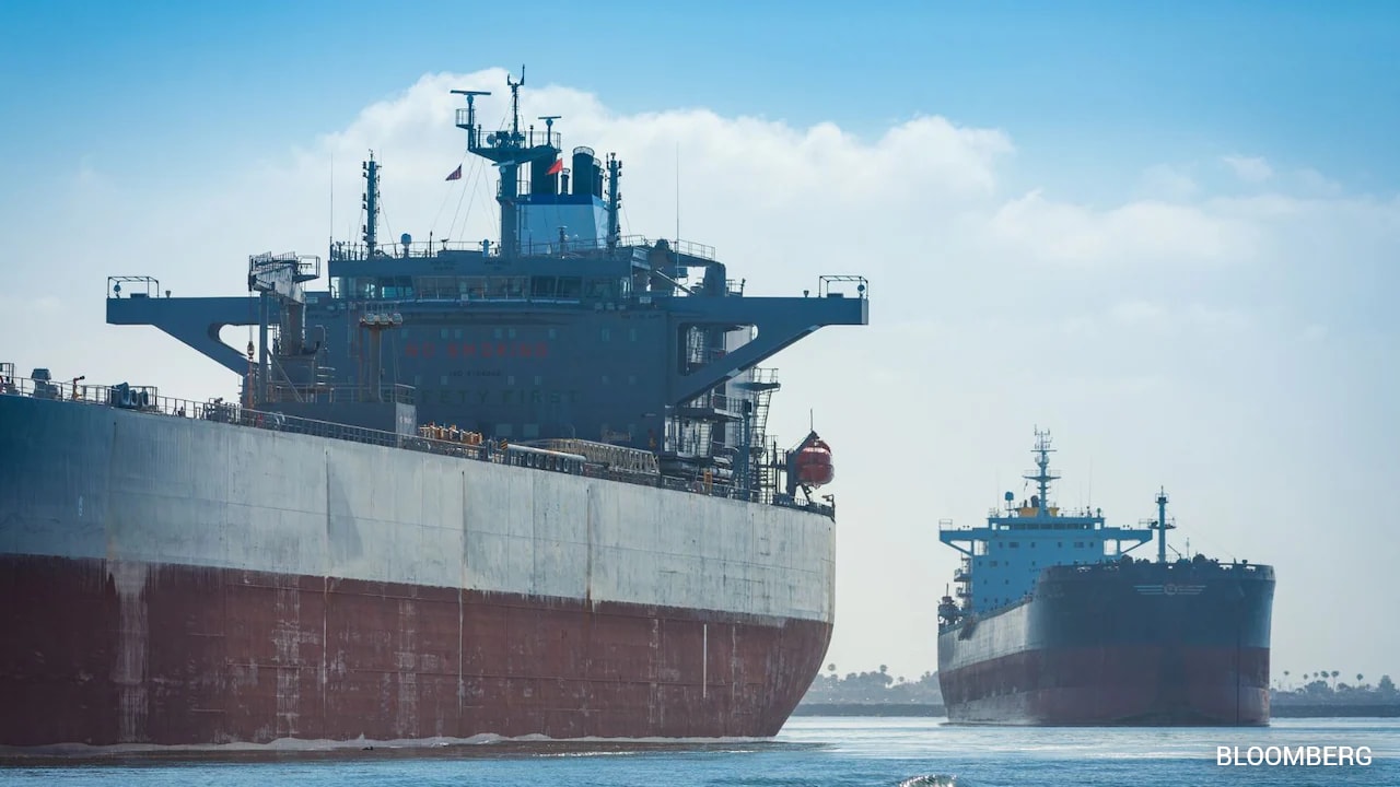
The Strait of Hormuz cannot be analyzed as an open-ocean environment. It is a highly constrained, shallow-water chokepoint where geography dictates the limits of tactical maneuverability.
The Traffic Separation Scheme (TSS)
The commercial shipping highway consists of a Traffic Separation Scheme managed by Oman. This scheme forces inbound and outbound traffic into two distinct lanes, each only two miles wide, separated by a two-mile buffer zone. Because these lanes lie within Omani territorial waters, any tactical deviation caused by an active threat instantly creates geopolitical complications and risks driving deep-draft vessels into uncharted or hazardous shallows.
Bathymetric Limitations
The depth of the strait varies significantly, dropping to roughly 100 meters in some areas but averaging less than 35 meters along critical segments of the shipping channels. This shallow profile alters the physics of naval warfare in two distinct ways:
- Acoustic Choking: Shallow water creates a high-reverberation environment. Sound bounces continuously between the surface and the rocky or sandy seabed, severely degrading the efficacy of active and passive sonar systems used by Western naval task forces to detect subsurface threats.
- Thermal Layering: Solar heating creates sharp thermoclines in the upper layers of the water column, bending sonar waves and creating acoustic blind spots where small submersibles or bottom mines can remain hidden from hull-mounted sensors.
The Three Pillars of Asymmetric Maritime Denial
A competitor's ability to close or severely disrupt the strait does not rely on matching the conventional blue-water tonnage of the US Navy. Instead, it leverages a triad of low-cost, high-leverage capabilities designed to maximize the time required for clearance operations.
1. The Sub-Surface Mine Function
The primary mechanism of denial is the deployment of naval mines. In shallow water, the threat vector shifts away from deep-sea moored mines to sophisticated bottom-influence mines. These systems sit directly on the seabed, rendering traditional mechanical sweeping (cutting mooring cables) useless.
Advanced bottom mines utilize multi-influence target detection sensors, tracking shifts in acoustic signatures, magnetic fields, and low-frequency hydrodynamic pressure changes caused by passing hulls. Furthermore, these mines feature ship counters, allowing them to remain inert while the first three minesweepers pass, only detonating when a high-value commercial asset enters the strike zone.
2. Swarm Kinetics and Anti-Ship Missile Integration
Minefields are rarely left undefended. The operational friction increases when mine clearance vessels, which must move slowly (often between 3 and 6 knots) to deploy specialized sonar and unmanned underwater vehicles (UUVs), are targeted by shore-based anti-ship cruise missiles (ASCMs) and fast attack craft (FAC) operating in swarms.
The defense math favors the asymmetric actor: a swarm of twenty armed speedboats disrupts the targeting radar of a defensive destroyer, forcing the capital ship to expend expensive, finite surface-to-air or point-defense munitions while exposing the slow-moving minesweepers behind it.
3. Smart Loitering Aerial and Surface Assets
The introduction of low-cost, one-way attack unmanned aerial vehicles (UAVs) and explosive-laden unmanned surface vessels (USVs) introduces a continuous, unpredictable kinetic variable. These assets target the bridge superstructures and steering gear of commercial tankers. While they rarely sink a double-hulled Very Large Crude Carrier (VLCC), they induce structural damage and fire, achieving a functional mission kill by rendering the vessel unnavigable.
The Strategic Divergence: Clearing vs. Securing
The core of the disagreement between the US military establishment and its European allies lies in the definition of operational success. The US planning model focuses on area clearance through overwhelming kinetic suppression, while the European model prioritizes corridor verification and risk management.
The US perspective assumes that the threat can be neutralized rapidly by targeting the land-based infrastructure supporting the denial strategy. This involves striking missile silos, coastal radar stations, naval bases, and command-and-control nodes. The assumption is that once the source of the kinetic threat is destroyed, mine clearance can proceed under a comprehensive air defense umbrella.
The European perspective recognizes that even if 95% of land-based assets are eliminated, the residual 5% threat keeps the strait functionally closed to commercial shipping. The Western European reliance on Persian Gulf energy imports creates a vulnerability that cannot tolerate a prolonged, high-intensity conflict. For European planners, the presence of even a single unlocated bottom mine or a hidden mobile missile launcher means the risk equation remains unfavorable.
The operational timeline bottleneck can be expressed as a linear relationship between mine clearance velocity ($V_c$) and the total area of the shipping channel ($A$). If a mine countermeasures vessel can scan only a fraction of a square mile per hour due to the high-reverberation hydrographic conditions detailed above, clearing the entire TSS to a 99% confidence level requires weeks, not days.
The Commercial Insurance Bottleneck
The military capability to destroy a threat does not automatically restore global commerce. The ultimate arbiter of whether the Strait of Hormuz is open is not a naval commander; it is the marine insurance underwriting community in London and global financial centers.
When a maritime zone is declared a War Risk Area by the Joint War Committee (JWC), Hull War premiums and Protection and Indemnity (P&I) clubs adjust their pricing based on actuarial probability, not military assurances.
This mechanism functions through a strict economic chain reaction:
- Premium Spikes: Within hours of an kinetic incident or a confirmed mine deployment, war risk additional premiums can escalate from a nominal percentage to 5% or 10% of the ship’s total value per transit. For a modern VLCC valued at $100 million, a single transit can demand millions of dollars in upfront insurance costs.
- The Seafarer Variable: Maritime labor unions retain the right to refuse transit through active war zones, or demand double wages for crews entering the area. This adds severe operational overhead and legal liabilities for ship operators.
- The Sovereign Guarantee Deficit: If private underwriters refuse to cover vessels entirely, governments must step in with state-backed sovereign indemnity schemes. The US and its allies disagree heavily on who carries the financial liability for these guarantees, creating a policy logjam that stalls commercial shipping even if the US Navy declares the shipping lanes "statistically safe."
Technical Limitations of Modern Mine Countermeasures
The belief that modern technology enables rapid clearance of a chokepoint ignores the physical limits of underwater detection. Mine Countermeasures (MCM) rely on a sequential process: Detection, Classification, Identification, and Neutralization.
Detection and Classification Limitations
Side-scan sonars and Synthetic Aperture Sonars (SAS) towed by ships or integrated into Autonomous Underwater Vehicles (AUVs) map the seafloor. In the shallow, rocky environment of the strait, the seabed is littered with non-mine bottom objects (NOMBOs), including discarded tires, sunken debris, and rock formations. Every NOMBO that shares the acoustic dimensions of a bottom mine must be treated as a mine until proven otherwise.
The Identification Bottleneck
Once a contact is classified as a mine-like object, an asset must close the distance to identify it visually or via high-frequency identification sonar. This requires deploying a Remotely Operated Vehicle (ROV) tethered to a surface ship, or sending explosive-disposal divers. This process is time-intensive and heavily disrupted by the strong tidal currents characterizing the Strait of Hormuz, which frequently exceed 3 to 4 knots, pushing ROVs off course and limiting diver endurance.
Neutralization Realities
If a mine is identified, it must be neutralized using an explosive charge placed by an ROV or diver, or destroyed via a single-shot mine disposal vehicle. This is a one-by-one operational cadence. If an adversary has deployed several hundred mines across the chokepoint, the mathematical time required to clear the path stretches into a multi-week operational campaign, completely disrupting just-in-time global supply chains.
Tactical Reconfiguration: The Operational Playbook
Naval task forces operating in the region must abandon the assumption that conventional deterrence will keep the strait open. To mitigate the strategic divergence between allies and counter the asymmetric threat effectively, operational doctrines must shift toward a decentralized, high-frequency clearance and escort framework.
- Deploy Persistent Underwater Surveillance Networks: Rather than waiting for a conflict to map the seabed, task forces must maintain continuous, high-resolution bathymetric baselines using autonomous surface vessels equipped with synthetic aperture sonar. This allows immediate change-detection analysis the moment a covert mining operation is suspected, isolating newly introduced anomalies within minutes rather than weeks.
- Establish Distributed Airborne Mine Countermeasures Nodes: Transition the bulk of primary detection from slow, vulnerable surface ships to airborne platforms like MH-60S helicopters utilizing Airborne Laser Mine Detection Systems (ALMDS) and Coastal Battlefield Reconnaissance and Analysis (COBRA) systems. This removes human crews from the immediate kinetic threat envelope of bottom mines and swarm attacks during the initial phase of clearance.
- Create Sovereign Maritime Indemnity Pools: Allied nations must pre-negotiate a multi-lateral state-backed insurance framework to instantly absorb commercial hull risk during the first 14 days of a crisis. By removing the private insurance bottleneck before premium spikes freeze commercial traffic, allies prevent an adversary from achieving an economic victory through financial panic alone, preserving the continuity of global energy flows while tactical clearing operations proceed.