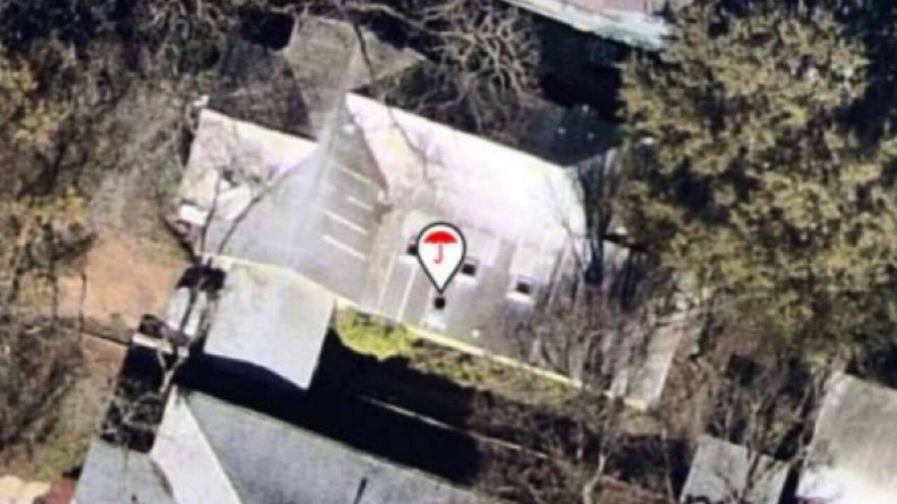
Property insurance underwriting has transitioned from a periodic, policyholder-attested model to a continuous, high-frequency surveillance regime. When a policyholder with a decade of loss-free history faces abrupt non-renewal due to satellite or drone imagery, it signals a systemic shift in how risk is quantified, priced, and executed. Insurers no longer rely solely on historical claims data to measure probability of loss; instead, they capture macro-level spatial data to identify static vulnerabilities before a loss event occurs. This operational pivot exposes a structural disconnect between long-term customer loyalty metrics and algorithmic risk evaluation.
The Economics of Continuous Underwriting
Traditional insurance underwriting operates on lagging indicators. Premium adjustments and non-renewal triggers historically followed a simple feedback loop: policy inception, annual premium payment, loss event occurrence, claims adjustment, and subsequent rate revision. This reactive structure rewarded risk avoidance implicitly, allowing properties with deferred maintenance to remain on the books indefinitely so long as no formal claim was filed.
Continuous surveillance disrupts this equilibrium by substituting lagging indicators with leading spatial data. Insurance carriers contract with third-party aerial imagery providers equipped with fixed-wing aircraft, high-resolution satellites, and low-altitude drones. These systems capture oblique and nadir imagery of residential and commercial parcels at regular intervals.
The economic rationale for this shift is straightforward margin defense. Catastrophic weather events and inflationary construction costs have compressed carrier profitability. To mitigate exposure, underwriters seek to eliminate properties exhibiting high-severity hazard indicators long before those hazards manifest as claims.
The Cost Function of Spatial Risk
The underwriting risk function is traditionally expressed as expected loss multiplied by severity. Spatial surveillance alters the expected loss variable by identifying physical deviations from baseline underwriting standards.
- Hazard Proximity Vectors: Measuring precise tree canopy overhang relative to roof structures, quantifying combustible material storage within defensible space radiuses, and detecting compromised roof membrane integrity via thermal or visual degradation signatures.
- Asset Depreciation Metrics: Evaluating the structural decay of secondary outbuildings, unpermitted additions, or degraded swimming pool barriers that introduce liability exposure.
When these variables cross a static algorithmic threshold, the automated underwriting engine flags the account. The policyholder's ten-year clean claims record becomes irrelevant because the spatial risk model assesses structural exposure, not behavioral probability.
The Mechanics of Automated Property Inspection
To understand how aerial surveillance triggers cancellations, one must examine the workflow from raw data capture to policy action. The process relies on computer vision models trained to detect specific property features that correlate with historical loss data.
Raw Spatial Capture -> Computer Vision Feature Extraction -> Hazard Scoring -> Automated Underwriting Trigger -> Adverse Action Notice
Feature Extraction and False Positives
Computer vision algorithms analyze high-resolution pixels to classify roof types, calculate pitch, and identify surface anomalies such as missing shingles, curling composition materials, or rust accumulation on metal panels. However, machine learning classifiers present a structural limitation: high rates of false positives driven by visual ambiguity.
A shadow cast by a dense oak tree can mimic the visual signature of a roof patch or a structural sag. Moss accumulation, which is primarily cosmetic in many climates, is frequently categorized by automated classifiers as moisture-induced substrate rot. Because carriers scale these operations across millions of parcels annually, manual verification of every flagged property is economically unfeasible. The algorithmic assessment often serves as the final arbiter, generating cancellation or remediation notices without human confirmation.
The Remediation Bottleneck
When a policyholder receives an adverse action notice citing aerial imagery findings, they enter a remediation protocol characterized by high friction and strict timelines. The burden of proof shifts entirely to the property owner.
- Notice of Non-Renewal: The carrier issues a formal warning or cancellation notice, typically providing thirty to sixty days to rectify the identified hazard.
- Independent Verification Requirement: The insured must hire a licensed contractor or certified home inspector to document that the flagged condition does not exist or has been corrected.
- Re-Inspection Friction: The contractor's report, accompanied by timestamped photographs, must be submitted through proprietary portals. The carrier then schedules or reviews secondary imagery, introducing administrative delays that can leave the property uninsured during the interim.
This workflow creates an asymmetric compliance cost. The insurer automates the identification of risk at scale, while the consumer bears the manual, financial burden of disproving the algorithmic finding.
Regulatory and Market Implications
The widespread adoption of aerial surveillance in property insurance creates friction with existing regulatory frameworks designed around traditional rating bureaus and historical loss data. Insurance commissioners in multiple jurisdictions are scrutinizing whether the rapid deployment of proprietary, unverified imagery algorithms violates statutes governing unfair discrimination and transparency.
The Transparency Gap
Traditional insurance pricing relies on rating schedules filed with state departments of insurance. These filings outline the exact factors used to calculate premiums, allowing regulators to verify that rates are neither excessive, inadequate, nor unfairly discriminatory.
Aerial surveillance introduces a black-box problem. The computer vision models and proprietary risk-scoring algorithms utilized by third-party vendors are protected as trade secrets. When a policyholder is penalized or dropped based on a metric they cannot independently access, audit, or challenge, the foundational transparency of the insurance market erodes.
Market Contraction and Redlining by Algorithm
As carriers aggressively shed perceived risk based on aerial data, certain geographic regions experience localized capacity crunches. Properties in wooded areas, older suburbs with mature tree canopies, or regions prone to windstorms face synchronized non-renewals across multiple carriers.
This behavior mimics traditional redlining, albeit driven by automated spatial proxies rather than demographic inputs. If an entire zip code features architectural styles or landscaping characteristics that algorithms flag as high-risk, the market effect is identical to systemic withdrawal. Homeowners find themselves forced into state-backed FAIR plans or surplus lines markets at significantly higher premiums for reduced coverage.
Strategic Action for Property Owners and Risk Managers
Navigating an insurance market governed by continuous aerial surveillance requires a shift from passive policy maintenance to proactive asset documentation. Property owners can no longer assume that silence from their carrier implies approval.
To insulate property assets from automated cancellation, stakeholders must implement a continuous verification defense.
- Preemptive Asset Auditing: Commission independent drone or roof inspections prior to policy renewal cycles. Maintain a verified digital ledger of roof installations, repairs, and tree trimming maintenance with certified invoices and high-resolution photographs.
- Immediate Dispute Calibration: Upon receiving an adverse notice derived from aerial imagery, bypass standard customer service channels. Submit structured counter-evidence consisting of professional engineering or roofing certifications that directly refute the specific spatial classification error identified in the notice.
- Carrier Algorithmic Disclosure: Demand explicit itemization of the third-party data vendor utilized for the assessment, exercising statutory rights to review consumer report data where applicable under insurance code provisions.
The transition from historical claims history to real-time spatial surveillance is permanent. Insurers will continue to optimize their portfolios by eliminating perceived structural vulnerabilities. The operational response must match this technological scale by maintaining an immutable, verifiable record of physical asset health that supersedes automated algorithmic error.