When the earth gives way at magnitude 8.8, the loudest part is not the roar. It is the silence that arrives a minute later, when your lungs remember they forgot to take a breath and the gulls over Avacha Bay lift off in a white ribbon without making a sound.
I have stood along northern Pacific coastlines after big tremors—not in Kamchatka itself, though I have walked black-sand beaches in Hokkaido and watched harbor pilings groan against swells that had no business being there. You learn quickly that an earthquake does not feel like a single blow. It feels like a room slowly losing its balance while you try to keep your feet under you. Glass rattles first. Then concrete hums. Then, somewhere deep beneath the sea floor, miles of rock that have been holding their breath for decades finally let go.
In 2025, a magnitude-8.8 earthquake tore along the Kuril-Kamchatka subduction zone, reminding the Pacific Rim how much energy can hide under cold water. A quake of that size does not merely topple chimneys or send tsunami waves racing across ocean basins. It leaves behind a map of what moved—and an even more unsettling map of what did not.
When seismologists and geophysicists mapped a locked zone behind Kamchatka’s 2025 magnitude-8.8 quake, they were not looking at a neat line on a chart. They were looking at friction, time, and unfinished business miles beneath the crust.
Why a Big Quake Can Leave Tension Behind
To understand a locked zone, start with a simple metaphor—and I want to be upfront that it is a metaphor, because rock under crushing pressure behaves in ways that wood and rubber only hint at. Picture two heavy boards pressed together while one tries to slide past the other. Where the grain is smooth, they creep along with barely a whisper. Where the grain catches, stress stacks up millimeter by millimeter until something snaps.
Subduction zones work on a planetary scale that humbles any human analogy. Off the eastern edge of the Kamchatka Peninsula, the dense Pacific Plate dives beneath the Okhotsk Plate along the Kuril-Kamchatka Trench, grinding forward at roughly seven to eight centimeters a year—about the pace your fingernails grow, multiplied across hundreds of kilometers of fault interface.
Along some stretches of that boundary, the plates slip smoothly or release energy in smaller bursts. Along other stretches, heat, pressure, and rock roughness weld the fault together. Geodesists call those stuck patches locked zones or asperities. Because the surrounding plate keeps moving while the locked patch stays pinned, elastic strain accumulates in the rock like tension coiled inside a spring.
A massive rupture—even a magnitude-8.8 event—rarely clears the entire ledger in one stroke. Slip during a great megathrust earthquake often concentrates in specific patches while neighboring segments remain stubbornly locked, or slip only partially, leaving pockets of high stress right next to areas that just relaxed.
Think about what happens to a rope pulled taut when one strand frays and parts. The remaining strands suddenly carry extra load. Seismologists watch how slip distribution during a major event shifts stress onto adjacent or deeper parts of the fault system, turning a single catastrophic release into a rearranged puzzle of strain.
A Morning on the Coast That Felt Too Quiet
Let me introduce a hypothetical character to ground what this geological geometry actually feels like on the ground. Call her Nadezhda, a harbor master’s clerk in a fictional coastal settlement south of Petropavlovsk-Kamchatsky, where diesel smoke mixes with salt air and snow lingers in gullies well into summer.
Hypothetical scenario: Nadezhda is drinking tea from a chipped enamel mug when the floor rolls twice—not a sharp snap, just a deep, sickening heave that makes the overhead lamp swing in slow arcs. Outside, fishing boats tug at their lines against water that looks oddly flat for a windy morning.
By the time the shaking fades, people are already moving toward higher ground, checking radios, calling relatives inland. When the first surge hits the bay, boats pitch wildly and gear slams against bulkheads, yet the worst of the immediate collapse stays below the scale some feared—partially because the main rupture unfolded along a specific geometry offshore.
The next day is harder in a quieter way. The tremors taper into aftershocks. The harbor cleans up tangled nets and bent railings. Life tries to return to routine.
Yet Nadezhda—and the scientists studying GPS stations, seafloor sensors, and seismic waves—knows the ground beneath her boots has not finished its story. Mapping a locked zone behind the 2025 quake means asking an uncomfortable question: if one section of the fault released so violently, what is still holding tight right behind or beside it?
How Scientists See What Is Stuck in the Dark
Nobody can drill straight down to the entire subduction interface along Kamchatka and take a look with a flashlight. The locked portion of a megathrust fault can sit tens of kilometers deep, buried beneath ocean water, sediment, and overlying crust.
So how do researchers map something locked in the dark? They read movement at the surface and trace waves through the earth.
GNSS and GPS receivers bolted into bedrock record tiny shifts—millimeters or centimeters over months and years—showing how the crust is being dragged inland or rebounding after a rupture. Interferometric synthetic aperture radar (InSAR) from satellites adds wide-area views of ground deformation across rugged volcanic terrain where field stations are sparse.
Seismic waveforms add another layer. When a great earthquake ruptures a fault, the way high-frequency energy radiates, where slip peaks, and how aftershocks cluster around the edges of the main slip patch all help researchers infer where the fault broke cleanly and where friction resisted slip.
Even in the aftermath of a magnitude-8.8 event, mapping a locked zone comes with real uncertainty. Rock properties change with depth and temperature. Afterslip—slow, aseismic creeping that happens in the weeks and months after a big quake—can gradually relieve stress in some places while loading others.
I will admit freely that earthquake forecasting can feel maddeningly incomplete when you want a simple yes-or-no answer. Science cannot hand coastal residents a stopwatch with an exact countdown. What mapping a locked zone gives instead is probabilistic clarity: knowing where strain is piling up helps engineers, emergency planners, and communities prepare for future shaking or tsunamis rather than guessing blind.
Why Kamchatka’s Geography Raises the Stakes
Kamchatka is not an empty postcard of smoking cones and wild rivers; it is one of the most tectonically active corridors on Earth. The Kuril-Kamchatka arc has produced some of the strongest earthquakes in modern instrumental history, including the famous November 4, 1952 quake—widely estimated around magnitude 9.0—which sent destructive tsunami waves across the Pacific.
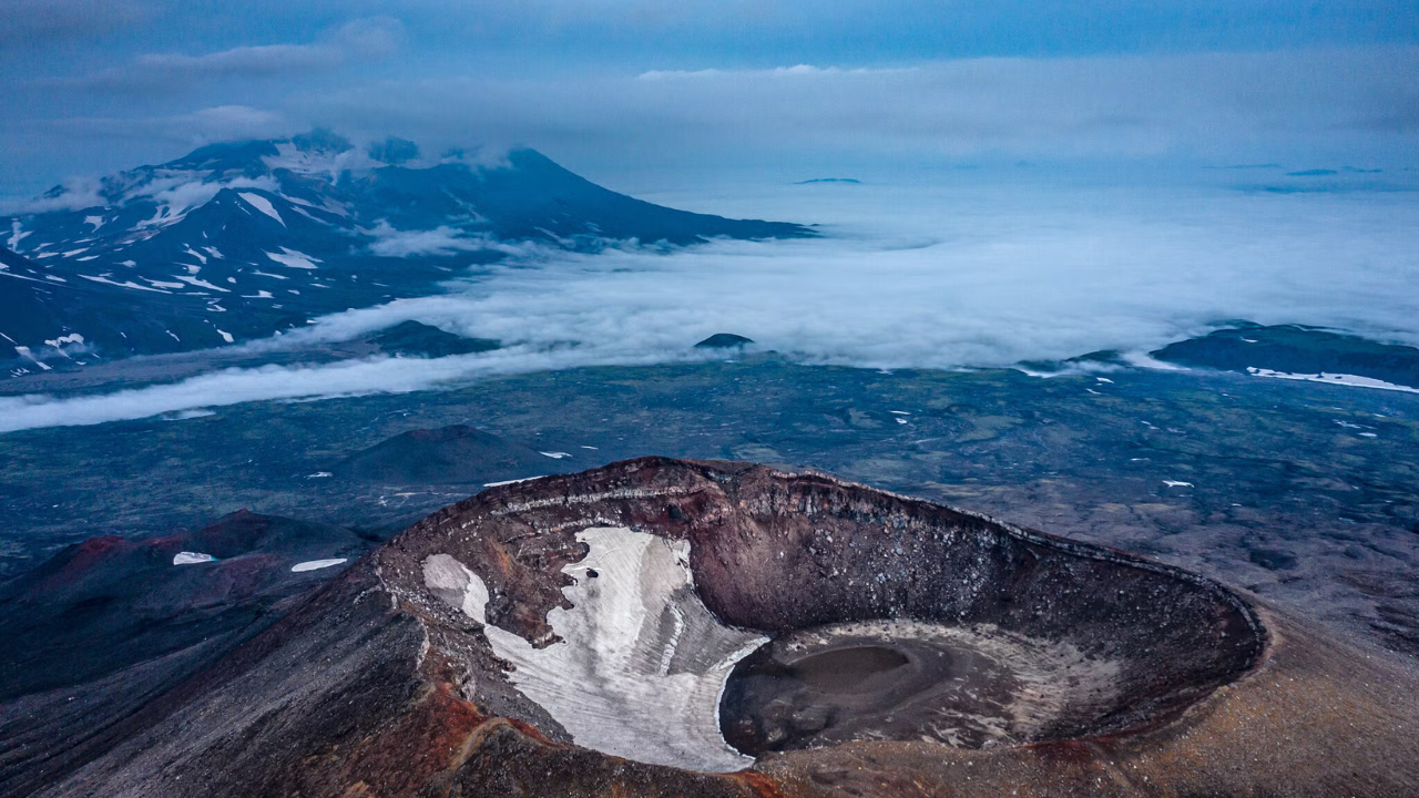
Here, subduction and volcanism share the same neighborhood. As the subducting plate descends and heats up, fluids driven off the slab rise into the overlying mantle wedge, fueling the chain of stratovolcanoes that define the peninsula’s skyline.
When a giant earthquake strikes a region already primed with magma systems, scientists pay close attention to how changes in crustal stress interact with nearby volcanoes. Sometimes ground deformation and stress shifts coincide with heightened unrest or eruptions; in other cases, volcanic activity reflects processes already underway. Either way, living in Kamchatka means living where fire and fault lines cross paths.
That brings up a question almost everyone asks after a megathrust quake: does a huge earthquake discharge the region’s danger for a long time, or can another big rupture still happen?
The honest answer is both—depending on which segment of the fault you mean. A large rupture relieves stress on the specific patch that slipped during that event. It does not automatically empty the reservoir on an adjacent or deeper locked section that stayed stuck. History along subduction zones—from Chile to Japan to the Pacific Northwest—shows that fault segments can break in sequences separated by years, decades, or centuries.
The Human Cost of Living on a Coiled Spring
It is easy to talk about megathrust mechanics from a warm desk thousands of miles away. Tectonic plates sound abstract until you picture a school hallway, a fuel tank near the shoreline, or a single coastal road cut by a landslide.
People who live along subduction zones develop a distinct kind of mental weather. You notice how tall the seawall is. You know which hillside trail climbs fastest if the water pulls back strangely after shaking. You carry a quiet skepticism toward anyone who claims nature is "done" just because the worst headlines have passed.
Mapping a locked zone behind Kamchatka’s 2025 magnitude-8.8 earthquake matters precisely because it bridges that gap between distant geophysics and everyday survival. When researchers pinpoint where the fault remains locked, governments and local agencies get sharper inputs for seismic hazard models, tsunami evacuation modeling, and infrastructure resilience.
Still, data alone does not pour stronger concrete or move a clinic out of a low-lying zone. That requires political will, funding in remote regions, and clear communication that respects people’s intelligence without numbing them with jargon.
What Lingers After the Ground Settles
Weeks or months after a giant quake, the news cycle moves on. New crises take the top of the feed. Yet deep below the cold waters off Kamchatka, the Pacific Plate keeps pushing at its slow, relentless pace, pressing against rock that remembers every millimeter of resistance.
Out on the water, a solitary fishing boat cuts through dark swell toward the open sea, its wake folding smoothly behind the stern as snow-dusted peaks watch from the shore—calm on the surface, carrying a weight the eye cannot see.


