Every monsoon, the regional news cycle runs the exact same script. A glacial lake breaches in the high Himalayas of Bhutan, downstream sirens wail in Assam and North Bengal, and editors immediately frame the crisis as an unavoidable act of alpine climate wrath.
It is lazy journalism. Worse, it is political cover.
When water from a Bhutanese moraine dam tears through the Brahmaputra basin, the headlines treat the event like an asteroid strike—sudden, external, and entirely beyond local control. That framing lets downstream administrators off the hook for decades of catastrophic floodplain mismanagement, wetland destruction, and blind dependence on failing structural engineering. A Glacial Lake Outburst Flood (GLOF) is the trigger, not the bullet. The bullet was loaded in the plains of India long before the ice melted.
The Anatomy of a Convenient Scapegoat
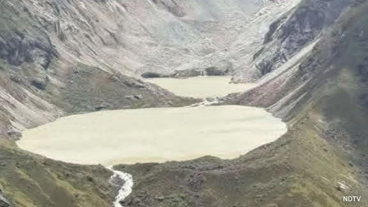
To understand why the standard reporting fails, look at the hydrology. Bhutan sits on the steep southern slopes of the eastern Himalayas, holding hundreds of glacial lakes—many of them supraglacial (forming directly on top of melting glacier ice) or moraine-dammed (held back by unstable piles of loose rock and glacial debris). When an ice avalanche drops into one of these lakes, or when the ice core inside a moraine melts, the natural dam fails. Millions of cubic meters of water drop thousands of feet in hours.
The media loves this narrative because it has a clean villain: global warming melting distant glaciers, sending a wall of water across an international border.
Here is what those reports leave out. By the time a flood wave from the Punatsangchhu, Mangdechhu, or Amochhu rivers crosses the border into West Bengal’s Dooars or western Assam, its peak discharge has already attenuated significantly through narrow mountain gorges. If the river had room to breathe once it hit the flat alluvial plains, the flood would spread, drop its heavy sediment load, and recharge depleted aquifers.
Instead, the water slams into a concrete straitjacket.
Over the last fifty years, flood control across the Brahmaputra and Teesta basins has meant one thing: building higher earthen embankments. I have watched state water resource departments pour billions of rupees into raising these dirt walls season after season, even as the riverbed inside them rises higher than the surrounding villages. When you trap a sediment-heavy Himalayan river between narrow levees, the silt has nowhere to go except straight down onto the channel floor. The river becomes an elevated aqueduct perched above populated towns.
When a Bhutanese glacial surge hits that choked system, the embankments do not hold. They breach violently. The resulting disaster is not a natural consequence of a melting glacier; it is the predictable failure of an engineered bottleneck.
What the Mainstream Coverage Gets Wrong About Glacial Outbursts
If you read standard coverage of Himalayan flood warnings, you would think engineers can simply drain every dangerous lake and call it a day. That brings us to the biggest misconceptions dominating public debate.
Can we just drain Bhutan’s glacial lakes to stop the floods?
No, and pretending otherwise wastes precious time and capital.
Lowering the water level of a high-altitude glacial lake—like Bhutan’s famous Thorthormi Lake, where workers spent years manually digging outlet channels at over 4,400 meters—is brutal, expensive, and extraordinarily slow. You cannot fly heavy excavators into jagged, oxygen-starved valleys without building roads that trigger massive landslides on their own. Even when you successfully siphon a lake by five or ten meters, rapid glacier retreat creates new depressions and new lakes upstream within a few summers.
Chasing every glacial lake in the eastern Himalayas with pumps and trenches is like trying to stop a leaking roof with a teacup. Mitigation in the high mountains reduces localized risk, particularly for Bhutanese valleys like Punakha, which was devastated by the 1994 Luggye Tsho outburst. For the downstream plains of Assam and Bengal, upstream lake draining will never offer complete protection.
Are early warning systems actually saving downstream communities?
They save lives, provided the sirens work, people have high ground to reach, and cross-border telemetry does not stall in bureaucratic limbo. They do almost nothing to save livelihoods, infrastructure, or topsoil.
Cross-border data sharing between Thimphu and New Delhi has improved significantly since the early 2000s, particularly through joint flood management commissions and automated hydro-meteorological stations. Knowing a surge is coming six hours ahead of time lets disaster response teams evacuate families from low-lying river islands—the chars of Assam.
Yet an early warning is an admission of defeat. It tells a farmer to abandon their standing rice crop, their livestock, and their home because the state has ceded the floodplain to unmanaged water. Warning systems are emergency triage, not flood resilience.
The Physics of the Plain: Why Concrete Makes Floods Worse
According to assessments by the International Centre for Integrated Mountain Development (ICIMOD), the Hindu Kush Himalaya region contains thousands of glacial lakes, with dozens in the eastern sector classified as potentially dangerous. Climate warming guarantees that freeze-thaw cycles and intense cloudbursts will destabilize more of these natural dams.
But look at what happens on the Indian side of the border where the rivers exit the foothills.
In North Bengal and western Assam, rapid highway expansion, railway embankments running perpendicular to natural drainage lines, and unchecked urban sprawl have paved over the region’s natural shock absorbers. Historically, the Brahmaputra and North Bengal river systems relied on beels (oxbow lakes and seasonal wetlands) and low-lying forest tracts to absorb monsoon surges.
Today, those wetlands are encroached upon, drained for real estate, or severed from the main river channel by roads with undersized culverts.
When a glacial outburst sends a sudden pulse of water—often carrying huge volumes of boulders, gravel, and uprooted timber—down from Bhutan, the water hits a landscape stripped of its hydraulic sponge. Because railway and road embankments block lateral sheet flow across the plains, water backs up behind infrastructure like a dam until the earthwork gives way. The sudden release creates a secondary flash flood far more destructive to local towns than the original mountain surge.
Blaming Bhutan’s glaciers for a flood caused by a poorly drained highway embankment in Jalpaiguri or Bongaigaon is pure misdirection.
What Needs to Happen Instead
If policymakers in Assam, West Bengal, and New Delhi want to stop evacuating hundreds of thousands of people every time a moraine slips in the Himalayas, they have to abandon the twentieth-century obsession with taming rivers through brute force.
1. Execute Strategic Retreat and Reconnect Floodplains
Stop rebuilding washed-out embankments on the exact same footprint. Where rivers exit the Bhutan foothills into the plains, authorities must designate wide, sacrificial flood zones—clearing illegal encroachments and reconnecting the main channels to historic wetlands and beels. Giving a flash flood room to spread drops its velocity and forces it to dump heavy sediment where it belongs, rather than blowing through downstream towns.
2. Redesign Linear Infrastructure for Peak Surge, Not Average Flow
Every new highway, bridge, and rail line across North Bengal and Assam must be audited against extreme GLOF-plus-monsoon scenarios, not historical 50-year averages. Bridges need wider spans instead of narrow piers that trap floating timber and debris—the exact mechanism that turns a bridge into a temporary dam before it collapses. Culverts need to be multiplied and widened so water moves through embankments rather than pooling behind them.
3. Shift from Crisis Relief to Amphibious Architecture and Resilient Crops
People living in chronic flood zones do not need another round of emergency tarpaulins; they need infrastructure built to get wet. Public buildings, schools, and grain stores in vulnerable districts should be elevated on reinforced concrete stilts above maximum projected flood lines. Agricultural subsidies must pivot away from water-sensitive crops in high-risk zones toward flood-tolerant rice varieties, floating agriculture, and aquaculture that treat seasonal inundation as an input rather than a catastrophe.
4. Demand Brutal Transparency in Cross-Border River Basin Modeling
India and Bhutan already cooperate on hydropower and flood telemetry, yet detailed downstream inundation models and real-time reservoir release schedules often remain locked behind opaque bureaucratic walls. Downstream districts need open-source, block-level inundation maps showing exact water depths under different glacial breach scenarios—not vague press releases warning of "rising water levels."
The Hard Truth About Taking Responsibility
There is an obvious political downside to this approach, which is precisely why no state government wants to touch it. Reclaiming floodplains means evicting powerful commercial interests, halting lucrative real estate development on wetlands, and admitting that decades of embankment contracts enriched contractors while endangering citizens. Telling voters that you cannot wall off the river requires political courage.
Pointing a finger north toward melting glaciers in Bhutan requires none at all.
The glaciers in the eastern Himalayas are going to keep melting, and the unstable moraines holding back their meltwater will continue to fail. You cannot negotiate with physics, and you cannot concrete your way out of Himalayan geology. Until downstream leaders stop treating mountain flood warnings as an excuse for their own negligence on the plains, every siren from Bhutan will keep ending in the exact same preventable ruin.