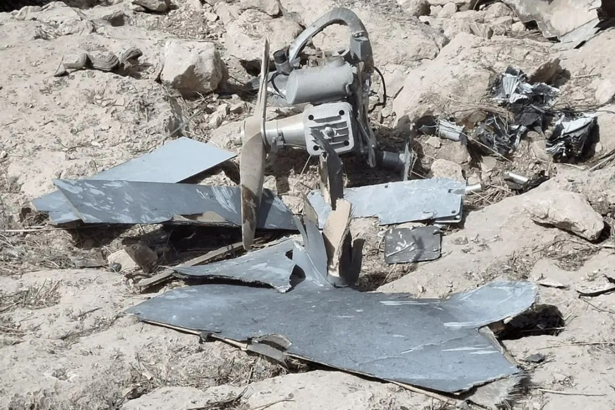
The shootdown of an American RQ-4A Global Hawk High-Altitude Long-Endurance (HALE) platform by an Iranian surface-to-air missile system near the Strait of Hormuz exposed a fundamental vulnerability in Western aerial reconnaissance doctrine. For decades, the United States operated under the assumption that extreme altitude coupled with flight paths in international airspace offered a de facto sanctuary for unarmed surveillance platforms. The destruction of the Broad Area Maritime Surveillance-Demonstrator (BAMS-D) variant over the Gulf of Oman shattered this operational premise, forcing a reassessment of how air power is projected in highly contested littoral zones.
This analysis dissects the technical, spatial, and strategic realities of the intercept off the coast of Bandar Abbas. It moves past geopolitical rhetoric to analyze the hardware, physics, and economic asymmetric realities that govern modern air-defense engagements in choke-point corridors.
The Technical Mechanics of the Intercept
The intercept was executed using the Sevom Khordad (3rd of Khordad), a medium-range, road-mobile air defense system operated by the Islamic Revolutionary Guard Corps Aerospace Force (IRGCASF). Mechanically similar to the Russian Buk-M2 system, the Sevom Khordad utilizes an active electronically scanned array (AESA) radar mounted on a Transporter Erector Launcher and Radar (TELAR) vehicle.
The engagement envelope of the system highlights the technical parameters of the shootdown:
- Target Platform: Northrop Grumman RQ-4A Global Hawk (BAMS-D). This aircraft has a wingspan of approximately 116 feet and operates at altitudes up to 60,000 feet ($18,300 \text{ meters}$).
- Interceptor Missile: Taer-2B. A solid-fueled, radar-guided missile designed to engage targets at ranges up to $105 \text{ km}$ and altitudes up to $27,000 \text{ meters}$.
- Radar Detection Profile: The RQ-4A, while featuring some low-observable shaping, possesses a significant radar cross-section (RCS) due to its massive non-stealthy engine intake, vertical stabilizers, and large physical profile.
To understand the detection timeline, we apply the standard radar horizon formula for line-of-sight tracking over a curved earth:
$$D_{\text{km}} \approx 4.12 \times (\sqrt{H_r} + \sqrt{H_t})$$
Where $H_r$ represents the height of the receiver antenna in meters (estimated at $10 \text{ meters}$ above sea level along the coastal cliffs near Bandar Abbas) and $H_t$ is the target's operating altitude ($18,300 \text{ meters}$).
$$D_{\text{km}} \approx 4.12 \times (\sqrt{10} + \sqrt{18300}) \approx 4.12 \times (3.16 + 135.28) \approx 570 \text{ km}$$
This physical calculation demonstrates that the RQ-4A was electromagnetically visible to Iranian coastal radar installations at a distance of up to $570 \text{ kilometers}$, long before it approached the kinetic engagement zone. The platform's lack of maneuvering capability and low thrust-to-weight ratio made it a highly predictable target once the Sevom Khordad's fire control radar achieved a hard lock.
Airspace Delimitation and the Geometry of the Clash
The primary diplomatic friction point centered on the precise spatial coordinates of the intercept. The United States asserted the aircraft was shot down in international airspace, approximately $34 \text{ kilometers}$ from the Iranian coast, while Iran maintained the platform violated its sovereign airspace over the Hormozgan province.
The geometry of the Strait of Hormuz complicates these assertions. At its narrowest point, the strait is only 21 nautical miles ($39 \text{ kilometers}$) wide. Under the United Nations Convention on the Law of the Sea (UNCLOS), sovereign territorial waters extend 12 nautical miles ($22.2 \text{ kilometers}$) from a nation's baseline.
This creates a highly compressed operational corridor:
- The Territorial Strip: A 12-nautical-mile zone of absolute sovereign control over both water and airspace.
- The Flight Information Region (FIR): Overlapping civilian air traffic control boundaries that do not confer sovereignty but require communication.
- The Kinetic Buffer Zone: Because modern surface-to-air missiles travel at speeds exceeding Mach 4 ($1,360 \text{ m/s}$), a platform flying at the edge of the 12-mile limit is within seconds of entering sovereign airspace if it initiates a bank turn.
The operational flight path of the RQ-4A placed it within the kinematic reach of coastal batteries even while operating strictly within international airspace. Because the target was flying a predictable, high-altitude racetrack pattern to maximize the slant range of its synthetic aperture radar (SAR) and signals intelligence (SIGINT) sensors, the IRGCASF was able to calculate an intercept geometry that minimized the flight time of the Taer-2B missile. This minimized the window for the drone’s crew—operating via satellite link from ground stations in the United States—to recognize the threat and execute evasive action.
The Economic Distortion of Attrition Warfare
The intercept exposed a stark asymmetry in the cost-exchange ratio of modern aerial surveillance. This economic imbalance is a core driver of defense planning in contested theater operations.
| System Variable | RQ-4A Global Hawk (BAMS-D) | Sevom Khordad (Taer-2B Missile) |
|---|---|---|
| Unit Cost | ~$110,000,000 to $220,000,000 | ~$150,000 to $250,000 (est.) |
| Crew Requirements | 3-4 Remote Operators / Analysts | 3-4 Mobile Tactical Operators |
| Replenishment Cycle | Multi-year manufacturing queue | Days to weeks (local assembly) |
| Mission Profile | Passive, non-evasive collection | Active, mobile kinetic defense |
The loss of a single BAMS-D platform represented a significant percentage of the United States Navy’s active high-altitude maritime reconnaissance fleet at the time. Conversely, the expenditure of a single indigenous missile represented a negligible fraction of Iran's defense budget.
This creates an unsustainable attrition model for the invading force. When the cost of the defensive effector is several orders of magnitude lower than the cost of the offensive or reconnaissance platform, the defender can comfortably engage in persistent saturation tactics. The economic bottleneck is not the availability of interceptors, but rather the political and material capacity of the projecting power to replace high-value, low-density assets.
Signal Intelligence and Electronic Warfare Post-Mortem
The failure of the RQ-4A to survive the engagement points to a critical vulnerability in the integration of its defensive systems. The BAMS-D, being an early development variant of the RQ-4 Triton line, lacked the advanced towed decoys and active electronic countermeasure (ECM) suites that are standard on newer survivability-focused platforms.
In a highly contested electromagnetic environment, the engagement sequence typically progresses through four distinct phases:
Phase 1: Passive Detection and Tracking
The coastal early-warning radars track the target's emissions (including its satellite link and transponder, if active) and its physical radar return. Because the RQ-4A lacks stealth characteristics, it cannot suppress its radar cross-section.
Phase 2: Fire Control Hand-Off
The target tracking is handed over to the Sevom Khordad's target-acquisition radar. This transition produces a distinct change in the target's internal radar warning receiver (RWR) alerts, shifting from search to track mode.
Phase 3: Missile Launch and Mid-Course Guidance
The Taer-2B is launched, receiving radio-uplink corrections from the ground station to adjust its trajectory toward the predicted intercept point. At this stage, the missile does not emit target-seeking signals, remaining virtually invisible to the drone's onboard passive sensors.
Phase 4: Active Homing Terminal Phase
In the final seconds of flight, the missile’s onboard radar seeker activates to home in on the target. Without active jamming pods, chaff dispensers, or high-G maneuvering capabilities, the RQ-4A was physically incapable of breaking the radar lock or out-flying the missile's proportional navigation profile.
The systemic failure lay in deploying a platform designed for permissive environments into an airspace monitored by an Integrated Air Defense System (IADS) that possessed the technical maturity to coordinate target acquisition across multiple frequency bands.
Defeating the High-Altitude Sanctuary Myth
The incident near Bandar Abbas serves as a definitive case study in the obsolescence of the high-altitude sanctuary doctrine. Strategic reconnaissance must transition from relying on altitude and distance to relying on survivability, low-observability, and distributed node networks.
Military planners operating in contested littoral environments must adapt their force posture through three primary structural shifts.
Decentralization of Sensing Nodes
The reliance on a single, multi-hundred-million-dollar platform like the RQ-4 must be replaced by distributed swarms of lower-cost, attritable unmanned aerial vehicles (UAVs). If the loss of a single node does not degrade the overall intelligence-gathering network, the economic leverage of the defender's SAM systems is neutralized.
Multi-Domain Integration
Reconnaissance must rely more heavily on space-based synthetic aperture radar (SAR) constellations and low-Earth-orbit (LEO) signals intelligence satellites. By shifting the primary collection burden to orbital assets, the risk of kinetic intercept is transferred to a domain where the legal and technical barriers to engagement are significantly higher.
Stand-Off Range Extension
To operate outside the kinematic envelope of modern SAM systems, sensor payloads must be developed with greater standoff ranges. If a SAM system has an effective range of $150 \text{ kilometers}$, the surveillance platform must carry optical, infrared, and radar systems capable of generating high-resolution imagery from $200 \text{ kilometers}$ or more, allowing the platform to remain deep within international airspace while still fulfilling its intelligence collection requirements.
The shootdown over the Gulf of Oman was not a mere border skirmish; it was a demonstration of the changing physics of modern air defense. It proved that regional powers possessing indigenous manufacturing capabilities can successfully challenge the air superiority of global powers by exploiting the inherent vulnerabilities of high-altitude, non-stealthy unmanned aviation. Future operations in restricted waterways will require a complete restructuring of the balance between platform survivability, cost, and mission utility.