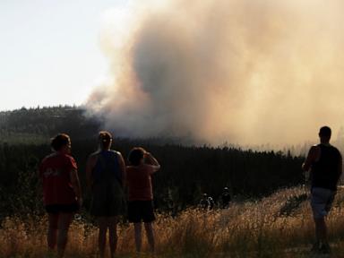
Severe wind events intersecting with dry vegetative fuel loads create an immediate operational crisis for emergency response systems in eastern Washington. When high-velocity winds align with low relative humidity and high temperatures, standard containment models fail. Emergency response shifts from a predictable containment strategy to dynamic triage. Understanding this phenomenon requires analyzing the underlying environmental variables, the cascading failure points of regional infrastructure, and the structural constraints of evacuation logistics.
The Environmental Mechanics of Rapid Spread
Wildfire velocity is a function of three primary environmental vectors: wind speed, fuel moisture content, and topographical slope. In eastern Washington, seasonal weather patterns frequently produce high-pressure systems over the Great Basin that force dry air westward through mountain passes. This atmospheric dynamic generates sustained winds coupled with low humidity.
When wind interacts with a flaming front, it transfers heat through forced convection. Instead of radiant heat slowly preheating adjacent vegetation, high-velocity air drives superheated gases directly into unburned fuel beds. This process accelerates ignition times exponentially.
[Atmospheric High Pressure]
          ↓
[Downslope Compression / Dry Air]
          ↓
[Sustained High-Velocity Winds] + [Depleted Fuel Moisture]
          ↓
[Exponential Convective Heat Transfer]
Vegetative fuel moisture drops significantly during summer months, reaching critical thresholds where dead brush and cured grasses act as high-efficiency kindling. Topography further amplifies this process. Canyons and valleys act as natural wind tunnels, compressing airflow and increasing velocity while preheating fuels upslope through chimney effects.
Infrastructure Vulnerability and Cascading Failures
The escalation from a localized brush fire to a regional evacuation event relies heavily on structural vulnerabilities within local infrastructure. Power distribution networks represent a primary ignition vector and operational bottleneck. High winds stress overhead utility lines, causing conductor clash, tree limb contact, and equipment failure. Each electrical fault introduces an ignition source into an already saturated landscape.
Utility operators face a difficult operational trade-off. Public Safety Power Shutoffs prevent ignitions by de-energizing lines, but they simultaneously disable municipal water pumping stations, communication relays, and traffic control infrastructure. Without a localized power grid, evacuation zones lose the technological redundancies required to manage population movement.
Roadway networks in rural eastern Washington exacerbate evacuation friction. Unlike metropolitan grids with redundant arterial routes, rural corridors often feature single-lane access routes flanked by dense vegetation. When a wind-driven fire front crosses a primary highway, it creates a total system blockage. Emergency responders must divert resources from active fire suppression to manage traffic gridlock, reducing overall system efficiency.
The Economics and Logistics of Evacuation Triage
Evacuation management is fundamentally a resource allocation problem under conditions of extreme uncertainty. Emergency management agencies operate within severe cognitive and logistical constraints. Predicting fire vectors in real-time requires continuous data assimilation from satellite telemetry, local weather stations, and aerial reconnaissance. However, shifting wind directions can render predictive models obsolete within minutes.
When evacuation orders are issued too early, agencies risk unnecessary economic disruption and resource fatigue. When orders are issued too late, evacuation corridors close before populations can clear the threat zone.
- Detection and Verification Window: The interval between ignition and initial sensor or human detection.
- Spread Velocity Modeling: Calculating the trajectory based on real-time wind speed and fuel availability.
- Threshold Determination: The precise moment mandatory evacuation orders supersede voluntary warnings.
- Corridor Execution: Moving human assets away from the dynamic threat vector while emergency assets move inward.
The friction within this sequence accounts for most civilian injuries and property losses during fast-moving events. Communication failures compound the logistical drag. Rural populations often rely on cellular networks that are vulnerable to fiber-cut events caused by burning utility poles or tower destruction from high winds. When standard communication channels fail, public dissemination reverts to manual methods, delaying compliance with evacuation directives.
Tactical Resource Deployment and Mutual Aid Constraints
Containment strategies rely on hierarchical resource deployment, moving from local volunteer departments to state and federal wildland firefighting assets. In fast-moving regional events, resource scarcity dictates operational limitations. Hand crews, heavy air tankers, and type-one incident management teams cannot be deployed instantaneously.
Air support operations face strict meteorological limitations. High-velocity winds and severe turbulence frequently ground fixed-wing aircraft and helicopters during the most critical phases of fire growth. When aerial assets are grounded, ground crews must confront advancing fronts without chemical retardant drops or rapid reconnaissance support.
Mutual aid agreements facilitate cross-jurisdictional support, but coordination overhead increases with every participating agency. Differences in tactical doctrine, radio frequencies, and equipment compatibility create friction points that slow down tactical execution on the fireline.
Strategic Assessment and Future Resilience
Mitigating the recurring crisis of wind-driven fires in eastern Washington requires shifting from reactive suppression to structural hardening. Hardening the electrical grid through underground cabling in high-risk corridors eliminates the primary human-made ignition vector during windstorms. Vegetation management programs must prioritize wide clearance zones around critical infrastructure rather than simple property-line thinning.
Regional emergency protocols must integrate decentralized alert systems that function independently of traditional cellular infrastructure, utilizing mesh networks or satellite-backed community sirens. Evacuation modeling should incorporate dynamic traffic flow simulations that account for sudden road closures, allowing emergency managers to direct populations toward pre-established safety zones rather than relying on linear highway escapes.
Future resilience depends on acknowledging the physical limits of direct suppression during extreme weather events. When atmospheric conditions align to produce catastrophic fire velocity, success is measured entirely by minimizing structural loss and preserving human life through disciplined, pre-planned spatial triage.