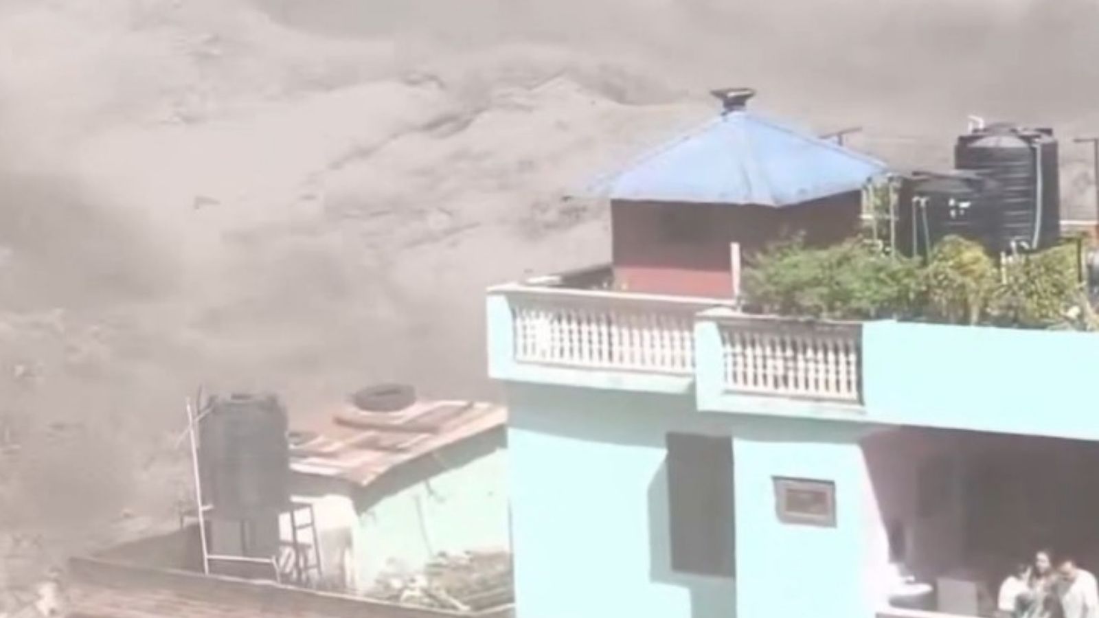
The fragile Himalayan frontier is once again bearing witness to a catastrophe of geography and climate. Along the rugged boundary separating the Tibet Autonomous Region from Nepal, torrential rains have triggered catastrophic flash floods and landslides, paralyzing the critical trading hub of Gyirong Port.
At least 558 people have been reported missing following the initial disaster on August 26, 2026. Hundreds of tourists, workers, and regional travelers remain uncontactable as communications, electrical grids, and arterial roadways lie completely severed. Learn more on a related issue: this related article.
Yet, the immediate inundation is only the opening act of a much more complex unfolding emergency.
The Ticking Clock of the Barrier Lake
High above the wreckage, a far more ominous hazard has taken shape. Debris and mudslides triggered by relentless precipitation have slammed across the confluence of the Chhochen Khola and Purepu Tsangpo rivers, creating an unstable natural barrier lake. More analysis by NPR delves into comparable views on the subject.
These waterways feed directly into the broader Bhote Koshi river system. As water continues to pool behind the newly formed earthen dam, the scale of the threat multiplies by the hour.
State media reports indicate that the reservoir has already accumulated millions of cubic meters of water. Meteorological models project that ongoing seasonal rainfall will pump millions more cubic meters into the basin over a narrow three-day window.
If the makeshift dam gives way, a violent wall of water will surge downstream. It will strike Gyirong Port and surrounding settlements with little to no warning.
Governments do not issue Level-IV emergency responses lightly. Beijing's Ministry of Water Resources mobilized immediate directives across Tibet, prioritizing hazard identification and real-time hydrological tracking.
Logistics and the Limits of Technology
Rescuers are fighting a punishing war against altitude, unstable slopes, and shattered infrastructure. Moving heavy machinery into the remote gorge is nearly impossible while roads remain blocked by ongoing rockfalls and mud.
To bypass these terrestrial bottlenecks, authorities have turned to high-altitude aerospace assets. The China National Space Administration has tasked orbital observation satellites with imaging the disaster zone and comparing current optics against historical baselines.
Unmanned aerial vehicles, including specialized thermal-imaging drones, sweep low over dense vegetation and mud-choked ravines. They hunt for heat signatures and construct three-dimensional volumetric models of the blockage.
Engineers from state-owned specialist enterprises have arrived at the epicenter with detection equipment to map the perimeter of the barrier lake. Every coordinate matters. Every centimeter of rising water dictates whether engineering teams can safely breach or drain the lake before it fails catastrophically on its own terms.
Military commands have deployed specialized personnel to coordinate joint rescue operations alongside local emergency responders. Prime Minister-level oversight underscores the gravity of the situation, with senior leadership inspecting the wreckage to supervise relief distribution firsthand.
The Cross-Border Vulnerability
Water respects no international boundaries. The disaster zone sits directly on a vital geopolitical and commercial artery between China and South Asia.
When infrastructure collapses here, the economic and human shockwaves ripple far beyond the immediate valley. Downstream communities in Nepal face the same acute risks as those on the Chinese side of the border.
Foreign missions have scrambled to issue travel advisories, warning citizens away from unstable mountain corridors where secondary landslides threaten to wipe out rescue camps.
The geography of the Himalayas makes this region uniquely vulnerable to cascading natural hazards. Steep gradients, heavy monsoonal moisture, and seismic activity combine to create a landscape in permanent motion.
When a single slope gives way, it alters river courses, chokes valleys, and sets off a chain reaction that engineering solutions can struggle to outpace.
The immediate task is clear. Stabilize the barrier lake, account for the missing, and clear the debris safely.
The deeper challenge remains written into the stone walls of the mountains themselves. As weather patterns grow more erratic and high-altitude warming accelerates glacial melt and soil instability, the valleys of the Tibet-Nepal border will face recurring tests of resilience.
For now, all eyes remain fixed on the creeping waterline of the barrier lake, waiting to see if engineering intervention can outpace the next heavy downpour.