The High Ground of History
Modern warfare relies on satellites, drones, and long-range ballistic vectors. Yet, on the ground, the ancient geometry of conflict remains stubborn. When military forces push into southern Lebanon, they consistently gravitate toward the exact same ridges, bluffs, and stone promontories that medieval engineers fortified nearly a millennium ago. This is not a coincidence born of historical sentimentality. It is a harsh reality of topography.
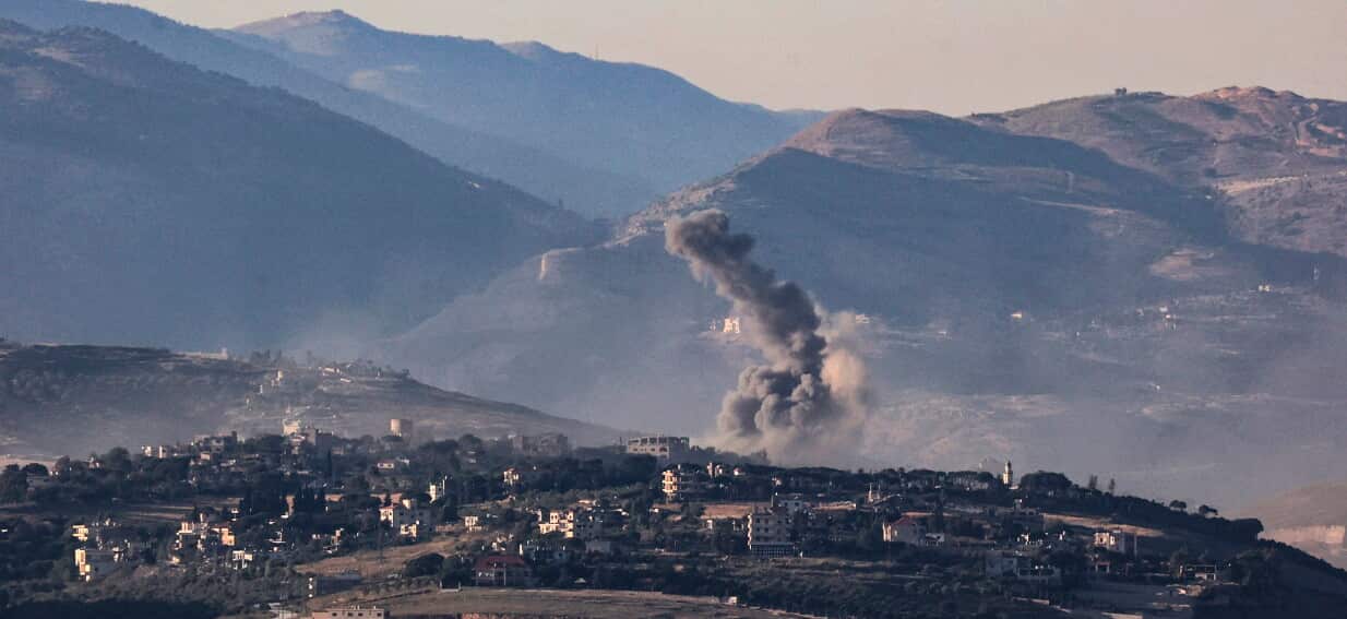
The recent operational focus on historic fortifications deep inside Lebanese territory highlights a recurring pattern in Levantine warfare. Armies do not occupy these crumbling stone fortresses to admire the masonry. They occupy them because the Crusaders possessed an flawless understanding of sightlines, dead zones, and choke points. To control the modern valley, you must still hold the ancient hill.
Geometry of the Ridge Line
The fortification network stretching across southern Lebanon—including sites like Belfort (Qala'at al-Shaqif) and smaller secondary outposts—was engineered in the twelfth century with a singular purpose. That purpose was total visual dominance over the Litani River basin and the corridors leading toward the Mediterranean coast.
[Western Coastal Plains] <---> [The Litani Choke Point] <---> [The Inland Valley Bypasses]
                                       ^
                                       |
                           [Crusader Ridge Fortresses]
When an army establishes a footprint in these areas today, the tactical calculus mirrors the logic of King Baldwin II. The stone walls themselves are highly vulnerable to modern high-explosive ordnance; concrete bunkers provide far better protection than medieval limestone. However, the plateau on which the ruins sit remains the premier observation platform in the region.
From these elevated positions, line-of-sight reconnaissance extends for dozens of miles. In a theater where asymmetric adversaries utilize deep ravines and dense brush for cover, holding the absolute highest point is the only way to effectively coordinate counter-battery fire and monitor tactical movements. The ancient walls are a liability, but the dirt beneath them is invaluable.
The Problem with Static High Ground
Relying on these historic high points introduces a severe tactical paradox. Because these locations are obvious, they are intensely surveyed by every actor in the region.
- Predictable Vectors: A ridge line that commands a valley is, by definition, visible from that valley. Every mortar crew and anti-tank guided missile (ATGM) team knows the exact coordinates of the ruins.
- Logistical Bottlenecks: The ancient tracks leading up to these fortresses are narrow, steep, and easily mined or ambushed. Supplying an advanced position on a isolated peak requires exposed movement along predictable routes.
- Subterranean Vulnerabilities: While conventional forces hold the surface and the stone battlements, asymmetric forces frequently utilize deep, hand-dug tunnel networks beneath the limestone karst topography, effectively bypassing the high ground altogether.
During the conflicts of the late twentieth century, the occupation of Belfort Castle served as a stark lesson in this vulnerability. The forces holding the citadel found themselves in a fishbowl, targeted by relentless mortar fire from the surrounding valleys. The high ground offered excellent observation but offered little protection against persistent, attritional bombardment.
The Karst Factor
The geology of southern Lebanon complicates the traditional high-ground advantage. The region is defined by karst limestone—soft rock easily hollowed out by water over millennia, and by human tools over decades.
An army standing on top of a Crusader hill may control the horizon, but they often do not control the subterranean space directly beneath their boots. This creates a multi-layered battlefield where the top layer is defined by medieval lines of sight and the bottom layer is defined by modern, reinforced tunnels.
Preserving History in a Combat Zone
The military occupation of cultural heritage sites triggers immense international scrutiny. Under the Hague Convention, the use of historic monuments for military purposes is strictly regulated, yet the realities of the terrain frequently override legal frameworks. When a crumbling castle happens to be the only position that prevents an anti-tank missile from targeting a valley supply route, military commanders almost always choose the high ground over historical preservation.
The damage inflicted during these occupations is rarely structural collapse from heavy artillery; modern militaries use precision munitions rather than carpet bombardment. Instead, the degradation is incremental. Heavy tracked vehicles chew up ancient foundations. Trenches cut through unexcavated archaeological strata. Sandbags and communication wires are anchored into eight-hundred-year-old mortar.
This creates a long-term cultural loss that persists long after the immediate tactical objective has been secured and abandoned. The fortresses of Lebanon have survived the Mamluks, the Ottomans, and the French Mandate, but each successive modern deployment leaves the stone more fragile than before.
The Illusion of Permanent Control
Securing a historic fortress creates a powerful psychological image of dominance. It looks like a definitive victory on a map. In reality, holding these points is an expensive holding action that drains manpower and equipment away from mobile operations.
The Crusaders built these sites because they lacked the manpower to patrol the valleys, using stone as a force multiplier. Modern armies possess the manpower but find themselves trapped by the same geography, forced to garrison the peaks just to keep the roads below open.
The cycle repeats because the terrain does not change. Satellites can map every square centimeter of the Lebanese border, but they cannot alter the fact that a soldier with a thermal scope standing on a Crusader ridge controls the movement of everything below him. The technology changes, the uniforms change, but the map remains completely indifferent to time.